Manukau heads observer wrote:big difference in weather from here then!
gusting to 31 knots here (58kmh) and mainly fine!
Yes! it seems that most of the country is under a fresh SW flow at the surface.. apart from Waikato to Rotorua! where winds are lightish easterly quarter.
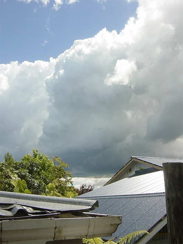
Hailstorm has cleared and now fine.. cicaidas back
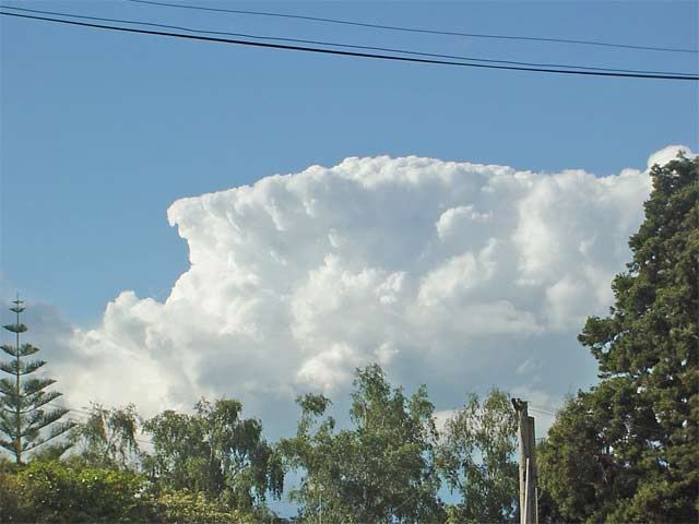
edit: Different cell to the WNW is booming thunder nicely.. here's a photo
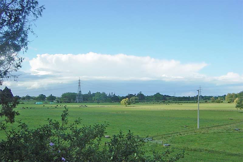
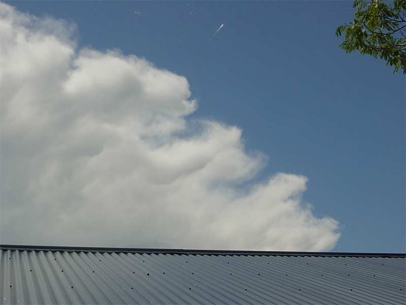
Yes, clear weather in Auckland now so an getting a good view of strong convection inland. Its low topped stuff due to a low tropopause, but the congestus is really firing. The midday sounding had the 500mb temp at -26c which is very cold for late November. I would estimate LI' to be around -3 this afternoon.
Took this photo around 4pm out at Ak Airport.
Shows Cb line out to our East/SE. I reckon your storm foggy might be out of the Cb at the far right side of the photo.
You do not have the required permissions to view the files attached to this post.
Down here it was quite wintry overnight with showers. I didn't notice any hail, but could've easily been some, and it was possibly cold enough for snow on top of Mt Herbert. But it's been sunny today with only passing clouds, though the fresh southerly's been keeping it rather chilly for the time of year.
Small possibilty of thunder in South Canterbury/North Otago tomorrow afternoon according to MetService, but I wouldn't hold my breath.
spwill wrote:Took this photo around 4pm out at Ak Airport.
Shows Cb line out to our East/SE. I reckon your storm foggy might be out of the Cb at the far right side of the photo.
Yes that was the hailstorm that passed over quickly towards the Coromandel
Nice shot!
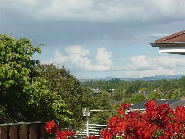
Few more..
Toward Hauraki Plains.
A tropical horizon to the east
Cheers..things have settled down now.. becoming fine.
A cold nightexpected tonight.. down to about 4c!
We have had a number of squalls with thunder & lightning pass through this afternoon. Only one with hail at about 3.30pm. Unfortunately I don't have my camera presently it's on loan (currently on holiday in Oz somewhere). I'm hoping the pattern will continue this evening so I get to see some nighttime displays
No more lightning overnight, darn. But it did cool right off, down to 8°C! Looking forward to it building back up to the anticipated high of 21°C today.
For info, there were quite a few thunderstorms around Canterbury on Monday afternoon. Most of them were hail producing storms near the ranges, but there were also a few near Ashburton. You can see the recorded lightning strikes on the MetService public met-strike viewer...
tgsnoopy wrote:No more lightning overnight, darn. But it did cool right off, down to 8°C! Looking forward to it building back up to the anticipated high of 21°C today.
Obviously a bit cooler overnight to the SE of you, 5°C here overnight. We have a way to go to get to a high of 21 here, the SW breeze is holding it down even though it is brilliant sunshine.
I will have Solar and UV sensors up soon, arrived today, but have to go to work soon, so they will have to wait before I start getting readings from them.
Dropped down to 4c at the airport this morning.. 5c here in the city.
Already have the solar sensor.. just need to get the stand!
Will have data up in no time
Partly cloudy today with freshening southwesterlies, 19c
Interesting looking high cloud around midday in Chch today - looked glaciated, and maybe some virga in it. This cloud has broken up now, with just scattered high cloud. Rain predicted to arrive by evening; fresh NE wind at present, but no thunderstorms forecast.
Weather Watcher wrote:For info, there were quite a few thunderstorms around Canterbury on Monday afternoon. Most of them were hail producing storms near the ranges, but there were also a few near Ashburton. You can see the recorded lightning strikes on the MetService public met-strike viewer...
...but there was nothing really exciting enough to go and chase, bit dismall really as most of the sky was 8/8 grey nimbo-stratus and you couldn't see any thunderheads
Interesting too on Monday was the steam on the road as the cold rain was falling onto it
Sunshine to warm the ground plus a fresh NE wind = some of the ingredients for thunderstorm activity in Canterbury. That's what we've had in Chch this afternoon. But the approaching southerly front doesn't seem to have enough cold unstable air behind - 4pm radar shows only light showers advancing into South Canterbury. Clouding over now, but only looks like it'll gradually come onto light rain this evening.
Few wee spits of rain here before but nothing now we may only get a few MM from this front overnight iam thinking.
Interesting small Cumulus cloud formed in a straight line to my NE around half past five perhaps this was due to the NE out at sea who knows.
Interesting thing on Campbell live tonight about someone who got struck by lightning was it in NZ or NSW because I missed it only caught the end as NSW also got some spectacular storms last night.
Cheers
JASON.
You do not have the required permissions to view the files attached to this post.
did this report make it onto the forum.
Waterspouts arn't unusual over eastern Auckland/Northland waters.
Newstalk ZB
22 November 2005
Forecasters say unusual weather patterns will be behind a strange sight on the Whangaparaoa Peninsula north of Auckland. Red Beach resident Joan Morrison spotted a fountain of water just before midday which she says looked like a tornado - only with water. She says the water spout extended from the horizon up to the clouds like a big twister.
Bob McDavitt from MetService says a southwesterly change over the northern parts of the country is to blame. He says it is producing unstable clouds which is creating unusual phenomena such as the water spout seen off Red Beach. Bob McDavitt says there could also be hail in western parts of the Waikato and the Bay of Plenty today.
NZstorm wrote:did this report make it onto the forum.
Waterspouts arn't unusual over eastern Auckland/Northland waters.
Newstalk ZB
22 November 2005
Forecasters say unusual weather patterns will be behind a strange sight on the Whangaparaoa Peninsula north of Auckland. Red Beach resident Joan Morrison spotted a fountain of water just before midday which she says looked like a tornado - only with water. She says the water spout extended from the horizon up to the clouds like a big twister.
Bob McDavitt from MetService says a southwesterly change over the northern parts of the country is to blame. He says it is producing unstable clouds which is creating unusual phenomena such as the water spout seen off Red Beach. Bob McDavitt says there could also be hail in western parts of the Waikato and the Bay of Plenty today.