Cheers
Lightning photo's
Forum rules
These topics are a read-only archive and may be subject to out-of-date information.
For today's weather discussion head to: New Zealand Weather & Climate
These topics are a read-only archive and may be subject to out-of-date information.
For today's weather discussion head to: New Zealand Weather & Climate
-
NZstorm

- Posts: 11333
- Joined: Mon 10/03/2003 19:38
- Location: Grey Lynn, Auckland
- Has thanked: 342 times
- Been thanked: 361 times
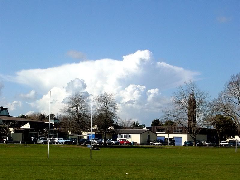
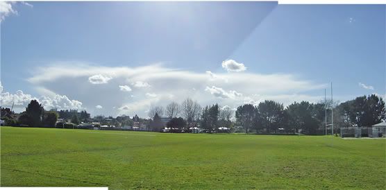
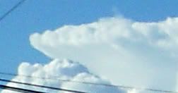
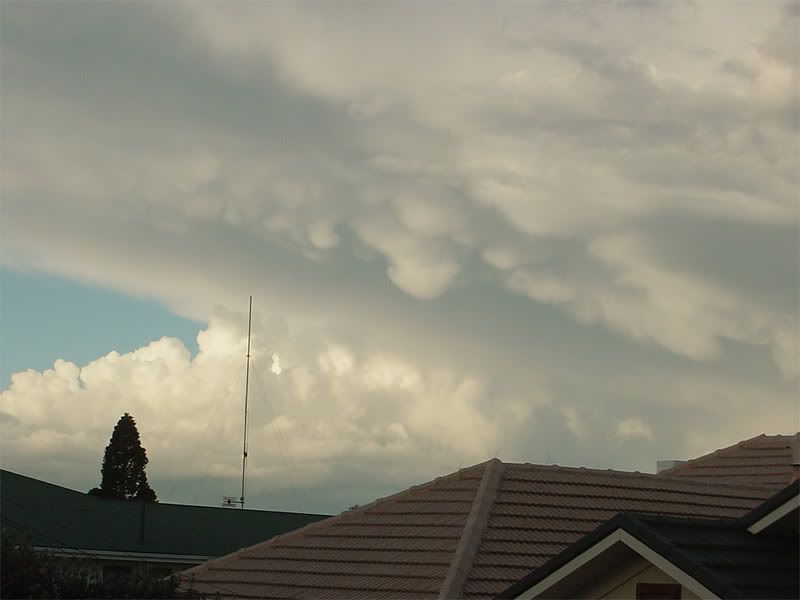
That Pukekohe cloud built up and glaciated into a weak cb. Will be giving Brian's place a good watering about now.
Edit, Brian reports thunder from this cloud on the other thread. So not that weak.
Edit, Brian reports thunder from this cloud on the other thread. So not that weak.
just had about 3 good claps of thunder.
You do not have the required permissions to view the files attached to this post.
-
Manukau heads obs
- Posts: 12305
- Joined: Mon 10/03/2003 16:30
- Location: West Coast Road, Manukau Peninsula, North Island
- Has thanked: 0
- Been thanked: 0
- Contact:
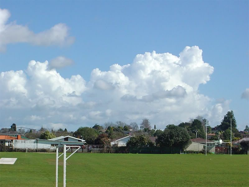
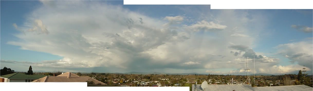
there was 2 cb's
one that went right up the peninsular
and hte 2nd that got pushed inland as the SWer developed...and then fillzled up now...
thats the one you photograhed nz storm
i was going to take a photo of it...but i was in the car...and when i got home it was looking old and haggered..
there must be an area of very strong updrafts, becuase there is lightning in thar clouds!

-
Willoughby

- Site Admin
- Posts: 4433
- Joined: Sat 14/06/2003 16:18
- Location: Darwin, Australia: Storm city
- Has thanked: 264 times
- Been thanked: 288 times
- Contact:
Got some good photos of it developing where you are, coming shortlyManukau heads observer wrote:there was 2 cb's
one that went right up the peninsular
and hte 2nd that got pushed inland as the SWer developed...and then fillzled up now...
thats the one you photograhed nz storm
i was going to take a photo of it...but i was in the car...and when i got home it was looking old and haggered..
there must be an area of very strong updrafts, becuase there is lightning in thar clouds!
-
Manukau heads obs
- Posts: 12305
- Joined: Mon 10/03/2003 16:30
- Location: West Coast Road, Manukau Peninsula, North Island
- Has thanked: 0
- Been thanked: 0
- Contact:
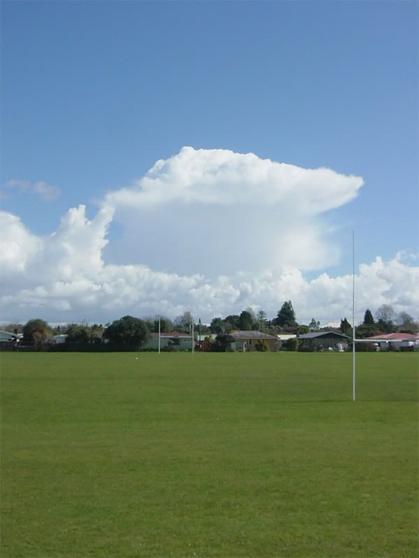
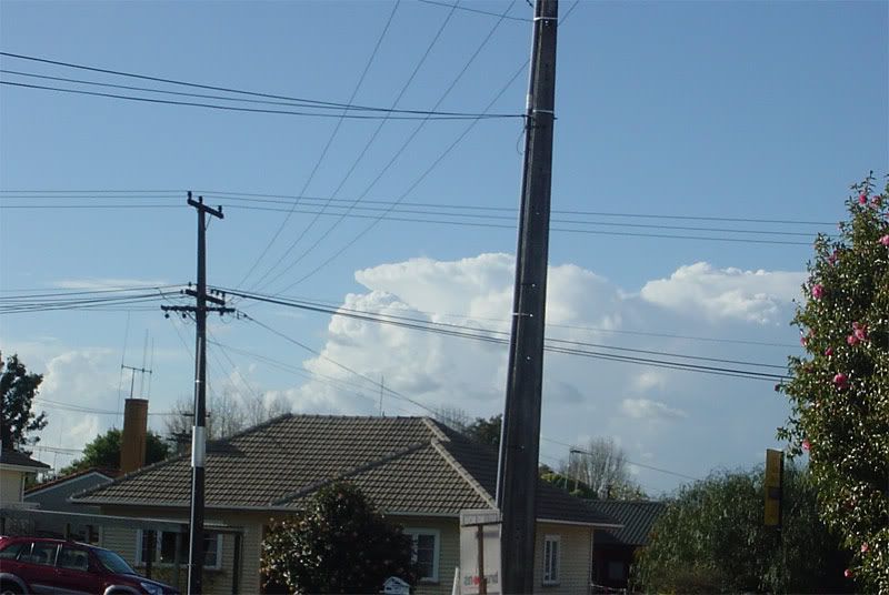
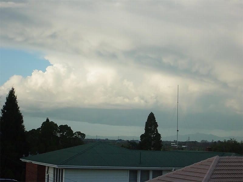
looking good, the cb line north of the city now....
check out ricky's web cam animation in about 5 minutes from now:
http://www.portunus.net.nz/weather/videolasthour.wmv
check out ricky's web cam animation in about 5 minutes from now:
http://www.portunus.net.nz/weather/videolasthour.wmv
-
Manukau heads obs
- Posts: 12305
- Joined: Mon 10/03/2003 16:30
- Location: West Coast Road, Manukau Peninsula, North Island
- Has thanked: 0
- Been thanked: 0
- Contact:
-
Willoughby
- Site Admin
- Posts: 4433
- Joined: Sat 14/06/2003 16:18
- Location: Darwin, Australia: Storm city
- Has thanked: 264 times
- Been thanked: 288 times
- Contact:

-
03Stormchaser

- Moderator
- Posts: 4428
- Joined: Tue 09/12/2003 12:11
- Location: Prebbleton
- Has thanked: 104 times
- Been thanked: 184 times
- Contact:
Re: Lightning photo's
Like your first photo!! Pity about the haze over the city all lit up.spwill wrote:Took some Lightning photo's this Evening from Mt Eden.
Storm was over Waikato.
NZ Largest Storm Chasing Facebook Pagehttp://www.facebook.com/nzstormchasers
NZ Largest Storm Chase Community https://www.facebook.com/groups/NZStormchasersGroup
NZ Stormchasers TV https://www.youtube.com/@NZStormchasers
NZ Largest Storm Chase Community https://www.facebook.com/groups/NZStormchasersGroup
NZ Stormchasers TV https://www.youtube.com/@NZStormchasers
-
Thunder
- Posts: 2068
- Joined: Wed 12/03/2003 19:47
- Location: Mt Somers
- Has thanked: 19 times
- Been thanked: 41 times
Great pics Foggy! That's what I like to see, I like "Rapid maturing stage. 1.11pm (Cb, NW) " . cool photo.
ahem, sorry to be a smart ass. lol!
Cheers
ahem, sorry to be a smart ass. lol!
I feel the day in cantab was not all lost either, just no storms unfortunately. It showed promis!Tomorrow seems like a good day for afternoon thunderstorms in the Auckland/Northland/Waikato area, I'd love to see some pop up so there's some good pic's and a report! The instability is there. The upper air gets cold while 850 mb temps stay the same so surface temps should be good creating an unstable laps rate. Will there be any trigger however? It seems more likely than today here in Cantab for sure.
Cheers

Aaron Wilkinson
-
Manukau heads obs
- Posts: 12305
- Joined: Mon 10/03/2003 16:30
- Location: West Coast Road, Manukau Peninsula, North Island
- Has thanked: 0
- Been thanked: 0
- Contact:
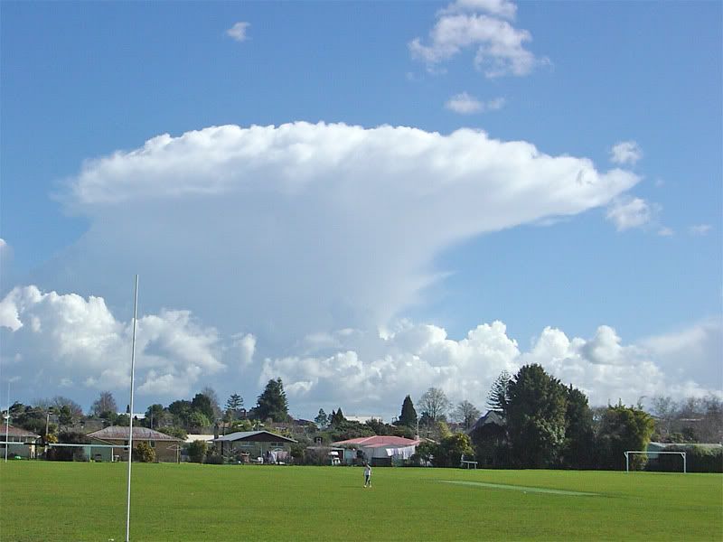
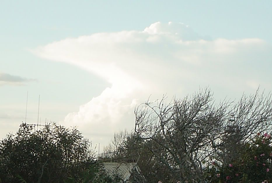
that cb north of auckland earlier
cb out to the east now too...but not looking as sharp edged as they were...
and check out ricky's web cam animation movie, looks real good, the first half of the sequence
http://www.portunus.net.nz/weather/videolasthour.wmv
cb out to the east now too...but not looking as sharp edged as they were...
and check out ricky's web cam animation movie, looks real good, the first half of the sequence
http://www.portunus.net.nz/weather/videolasthour.wmv
You do not have the required permissions to view the files attached to this post.
-
Willoughby
- Site Admin
- Posts: 4433
- Joined: Sat 14/06/2003 16:18
- Location: Darwin, Australia: Storm city
- Has thanked: 264 times
- Been thanked: 288 times
- Contact:
-
Willoughby
- Site Admin
- Posts: 4433
- Joined: Sat 14/06/2003 16:18
- Location: Darwin, Australia: Storm city
- Has thanked: 264 times
- Been thanked: 288 times
- Contact:
-
Manukau heads obs
- Posts: 12305
- Joined: Mon 10/03/2003 16:30
- Location: West Coast Road, Manukau Peninsula, North Island
- Has thanked: 0
- Been thanked: 0
- Contact:
-
Manukau heads obs
- Posts: 12305
- Joined: Mon 10/03/2003 16:30
- Location: West Coast Road, Manukau Peninsula, North Island
- Has thanked: 0
- Been thanked: 0
- Contact:
-
Gary Roberts
- Posts: 2363
- Joined: Sun 18/01/2004 18:59
- Location: Omarama
- Has thanked: 0
- Been thanked: 0