Some cu's starting to tower here as well, light southerly breeze. Potential for hail here if it happens today.
Well keep you posted.
End of the Golden weather...until!
Forum rules
These topics are a read-only archive and may be subject to out-of-date information.
For today's weather discussion head to: New Zealand Weather & Climate
These topics are a read-only archive and may be subject to out-of-date information.
For today's weather discussion head to: New Zealand Weather & Climate
-
Willoughby

- Site Admin
- Posts: 4433
- Joined: Sat 14/06/2003 16:18
- Location: Darwin, Australia: Storm city
- Has thanked: 264 times
- Been thanked: 288 times
- Contact:
Convection started from clear skies at 9am and is 4/8 now with building, towering Cu. Cu looks like it's really 'activating' to the southeast at the moment.
18c, light southerly.
Possible late evening shower in Auckland this evening- southwesterly becoming gusty up there, afternoon convective showers from the Bombay's southwards inland
18c, light southerly.
Possible late evening shower in Auckland this evening- southwesterly becoming gusty up there, afternoon convective showers from the Bombay's southwards inland
-
Willoughby
- Site Admin
- Posts: 4433
- Joined: Sat 14/06/2003 16:18
- Location: Darwin, Australia: Storm city
- Has thanked: 264 times
- Been thanked: 288 times
- Contact:
-
Manukau heads obs
- Posts: 12305
- Joined: Mon 10/03/2003 16:30
- Location: West Coast Road, Manukau Peninsula, North Island
- Has thanked: 0
- Been thanked: 0
- Contact:

-
NZstorm

- Posts: 11333
- Joined: Mon 10/03/2003 19:38
- Location: Grey Lynn, Auckland
- Has thanked: 342 times
- Been thanked: 361 times
Its 18C, fine here. Can see t/cu inland. Should see Isolated afternoon thunderstorms over the inland ranges late this afternoon. Nothing in the Waikato though foggy. Won't be the heat or humidity there today, required for thunderstorms although isolated showers possible. Will be a fine dry afternoon for Auckland.
-
Willoughby
- Site Admin
- Posts: 4433
- Joined: Sat 14/06/2003 16:18
- Location: Darwin, Australia: Storm city
- Has thanked: 264 times
- Been thanked: 288 times
- Contact:
-
Thunder
- Posts: 2068
- Joined: Wed 12/03/2003 19:47
- Location: Mt Somers
- Has thanked: 19 times
- Been thanked: 41 times
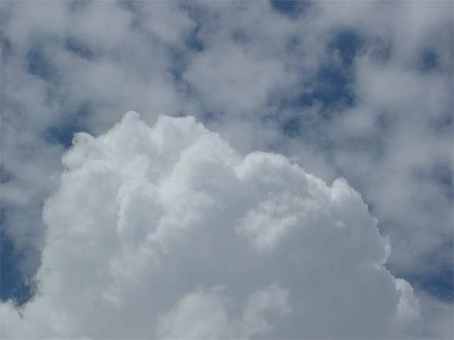
Some reasonable Cu going up on the foothills here but nothing (at this point) to get too excited about. I'm not liking the NE breeze we have at the moment, it's a little more breeze than I'd like keeping temps down a little.
Some bigger Cu congestus type towers further north (Culverdon?) which look better.
Hopefully a thunderstorm or two up north today. Yes NZstorm, that eastern area of the North Island does seem to be favoured for thunderstorms today.
Cheers
Some bigger Cu congestus type towers further north (Culverdon?) which look better.
Hopefully a thunderstorm or two up north today. Yes NZstorm, that eastern area of the North Island does seem to be favoured for thunderstorms today.
Cheers
You do not have the required permissions to view the files attached to this post.

Aaron Wilkinson
-
Achten
- Posts: 141
- Joined: Thu 20/03/2003 20:57
- Location: Hawkes Bay
- Has thanked: 0
- Been thanked: 19 times
- Contact:
Cb's around me, esp to the east. Jury is still out. They look good one moment then shabby the next. NZ Storm and others, when you talk about availability of moisture are you making a gut feel call or is this using info from soundings?. I would have though that the front yesterday that stalled and dissipaited over the North Island may have left enough residual moisture. Is that what we are seeing today?
-
Manukau heads obs
- Posts: 12305
- Joined: Mon 10/03/2003 16:30
- Location: West Coast Road, Manukau Peninsula, North Island
- Has thanked: 0
- Been thanked: 0
- Contact:
-
Willoughby
- Site Admin
- Posts: 4433
- Joined: Sat 14/06/2003 16:18
- Location: Darwin, Australia: Storm city
- Has thanked: 264 times
- Been thanked: 288 times
- Contact:
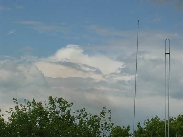
Not far from here, 25km or so around Cambridge delivering heavy showers there as I type.Manukau heads observer wrote:i can see that CB now foggy, must be Pirongia area?
Huge mother of a cumuloninbus has popped up 120km away S towards Taumarunui, will get pic up shortly.
Mostly cloudy and warmest centre atm, 22c with light variable winds.
Cu congestus to the west and north and east great T/Cu to the south, taking more pics!!
-
Thunder
- Posts: 2068
- Joined: Wed 12/03/2003 19:47
- Location: Mt Somers
- Has thanked: 19 times
- Been thanked: 41 times
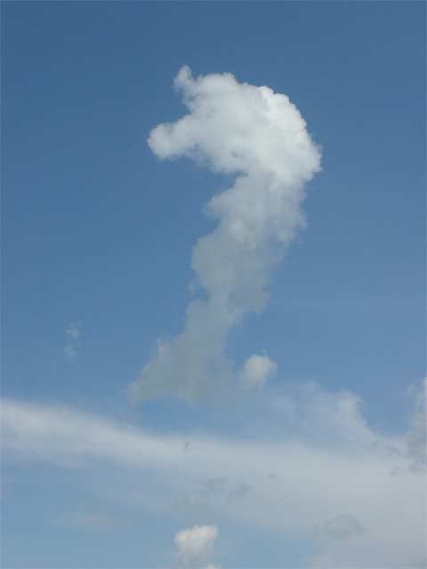
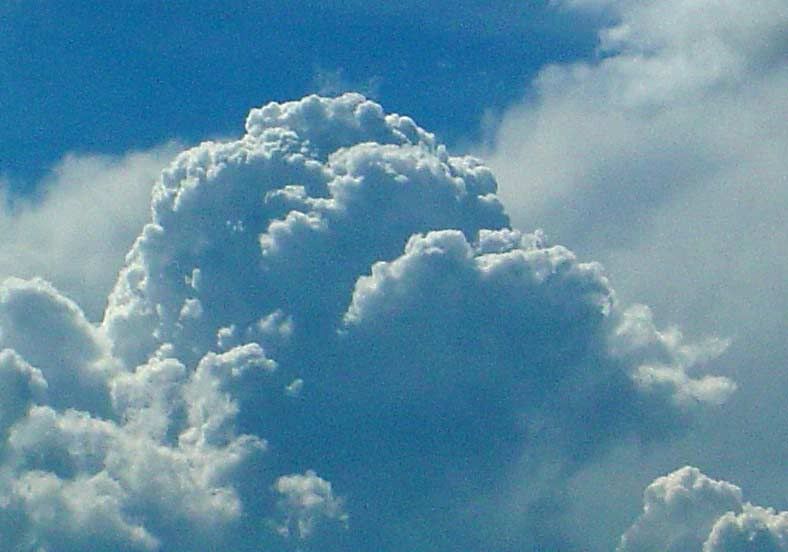
Cu to north has got bigger and looks good. Cu on plains has got a bit bigger but is being capped, it needs a little more umphh to get through it (i.e. temp, convergence etc).
There's a bit of low level scattered cloud in the pic below.
Edit: Hmm, even though I do see signs off some sort of capping on the foothills it does seem more unstable than other day's recently. I note some strong looking Cu congestus over Oxford at the moment. Hopfully something happens!
There's a bit of low level scattered cloud in the pic below.
Edit: Hmm, even though I do see signs off some sort of capping on the foothills it does seem more unstable than other day's recently. I note some strong looking Cu congestus over Oxford at the moment. Hopfully something happens!
You do not have the required permissions to view the files attached to this post.
Last edited by Thunder on Mon 31/10/2005 15:20, edited 1 time in total.
Aaron Wilkinson
-
Paul Mallinson
- Meteorologist (Retired)
- Posts: 406
- Joined: Thu 27/10/2005 20:44
- Location: Greytown
- Has thanked: 2 times
- Been thanked: 7 times
Hi folks,
Thanks for your welcome the other day.
Looks like the convective forecasts are working out so far this afternoon.
Sprinkling of lightning on the detector over the NI. I see we are getting storms in the Bay of Plenty area now. This area was pegged as severe today.
Anvil now to the north of Wellington over the Tararuas, should fire soon with trof approching from the top of the SI.
I see there is a flash over North Cny.
Cheers
Paul
-
Paul Mallinson
- Meteorologist (Retired)
- Posts: 406
- Joined: Thu 27/10/2005 20:44
- Location: Greytown
- Has thanked: 2 times
- Been thanked: 7 times
-
Willoughby
- Site Admin
- Posts: 4433
- Joined: Sat 14/06/2003 16:18
- Location: Darwin, Australia: Storm city
- Has thanked: 264 times
- Been thanked: 288 times
- Contact:
-
spwill
- Posts: 9917
- Joined: Sun 29/06/2003 22:39
- Location: Mt Eden Auckland
- Has thanked: 847 times
- Been thanked: 869 times
Thanks for the photo's.
Aaron, your last photo shows Cu and Cb.
Clear skies here so I can see those thundery Cb over Eastern Waikato /Bay of Plenty from here.
Aaron, your last photo shows Cu and Cb.
Clear skies here so I can see those thundery Cb over Eastern Waikato /Bay of Plenty from here.
Last edited by spwill on Mon 31/10/2005 15:56, edited 1 time in total.
-
Willoughby
- Site Admin
- Posts: 4433
- Joined: Sat 14/06/2003 16:18
- Location: Darwin, Australia: Storm city
- Has thanked: 264 times
- Been thanked: 288 times
- Contact:
-
Manukau heads obs
- Posts: 12305
- Joined: Mon 10/03/2003 16:30
- Location: West Coast Road, Manukau Peninsula, North Island
- Has thanked: 0
- Been thanked: 0
- Contact:
-
NZ Thunderstorm Soc
- Posts: 18489
- Joined: Wed 12/03/2003 22:08
- Location: Raukapuka Geraldine
- Has thanked: 1769 times
- Been thanked: 1412 times
JohnGaul
NZTS
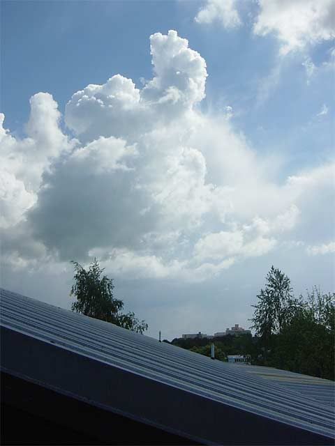
"Fists" going up this afternoon in inland areas. Glad you photographed them Aaron as there is lots of stratus moving in from the NE obscuring them from view here.
Seems to be Cb development to the north of here (Radar show shower activity possibly around the Waikari/Culverden area?)
A few weak sferics from about 3:50pm so possible lightning there ( haven't checked SG's lightning tracker yet)
NZTS
"Fists" going up this afternoon in inland areas. Glad you photographed them Aaron as there is lots of stratus moving in from the NE obscuring them from view here.
Seems to be Cb development to the north of here (Radar show shower activity possibly around the Waikari/Culverden area?)
A few weak sferics from about 3:50pm so possible lightning there ( haven't checked SG's lightning tracker yet)
-
Storm Struck

- Posts: 4865
- Joined: Wed 17/11/2004 21:25
- Location: Belfast Christchurch
- Has thanked: 23 times
- Been thanked: 375 times
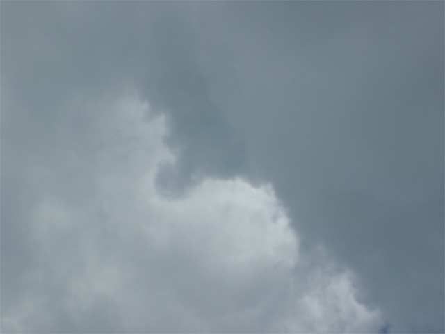
Yes CB north of here Culverdon way alright Aaron cant get much of photo at the moment low cloud is cleared from here but there's that annoying alstratus in the way with just heads poking through.
Got a pic b4 after got off the bus and just to note Some CU going up to SW now perhaps Rakia area Aaron? here's hoping that develops into something soon.
Cheers
JASON.
Got a pic b4 after got off the bus and just to note Some CU going up to SW now perhaps Rakia area Aaron? here's hoping that develops into something soon.
Cheers
JASON.
You do not have the required permissions to view the files attached to this post.
-
NZstorm
- Posts: 11333
- Joined: Mon 10/03/2003 19:38
- Location: Grey Lynn, Auckland
- Has thanked: 342 times
- Been thanked: 361 times
Looks to be a strong cb/thunderstorm in the vicinity of the Kaimai ranges at the moment. Stands out clearly from here in Auckland. Matamata would be a good spot to see this buildup.
Yes, interesting to see the cb pop up over the Mt Pirongia area this afternoon. I wouldn't have picked a cb development there today. It looked great when it first developed but didn't last long and looked to dissapate as quickly as it formed. Mt Pirongia area is a great spot for afternoon convection.
Yes, interesting to see the cb pop up over the Mt Pirongia area this afternoon. I wouldn't have picked a cb development there today. It looked great when it first developed but didn't last long and looked to dissapate as quickly as it formed. Mt Pirongia area is a great spot for afternoon convection.
-
Manukau heads obs
- Posts: 12305
- Joined: Mon 10/03/2003 16:30
- Location: West Coast Road, Manukau Peninsula, North Island
- Has thanked: 0
- Been thanked: 0
- Contact:
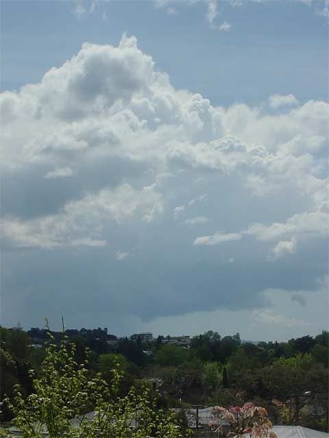
another big one went up quickly, must be east of huntly?
http://www.weather-display.com/nthwaikato.jpg
http://www.weather-display.com/nthwaikato.jpg