Graeme, excellent photos, well done.
I would like to know the total lightning count for northern NZ last night.
The static on the am band was continuous for about four hours.
Central Auckland got the best part of the storm between 1am and 2am with lots of forked lightning through the sky and the sky Tower looked to be hit a few times. I took some lightning photos on my SLR bulb, so pics still in the camera. But I was to disorganised, my camera got wet, so I feel I missed out on good photos.
I expect a few new thunderstorms to develop over northern NZ this afternoon with hail and very strong wind gusts possible in the storms.
Currently partly cloudy in central Ak with 17C and adjacent cloud building.
went to bed, bumped my head, and got up and it was raining!
Forum rules
These topics are a read-only archive and may be subject to out-of-date information.
For today's weather discussion head to: New Zealand Weather & Climate
These topics are a read-only archive and may be subject to out-of-date information.
For today's weather discussion head to: New Zealand Weather & Climate
-
tich
- Posts: 3472
- Joined: Sat 15/03/2003 18:32
- Location: Christchurch (St Albans)/Akaroa
- Has thanked: 22 times
- Been thanked: 92 times
I first heard about those northern storms on the radio news this morning - they were the first item. It rained here overnight (from sometime after midnight, after I'd gone to sleep) and at first this morning, but it soon cleared up. Now it's sunny, with only scattered clouds in Chch, but certainly alot colder than yesterday.
-
GraemeWi
- Posts: 1012
- Joined: Sun 30/03/2003 18:28
- Location: Hobsonville Point, Auckland
- Has thanked: 36 times
- Been thanked: 78 times
- Contact:
From roughly 10pm through to 2am the frequency of the visable lightning in my location was on average 1 every 30 seconds. Nearly 500 just for me! The view from here would cover from the Waitakeres through to Kaipara so thats a fair amount of area.NZstorm wrote:I would like to know the total lightning count for northern NZ last night. The static on the am band was continuous for about four hours.
Cheers,
G
-
Manukau heads obs
- Posts: 12305
- Joined: Mon 10/03/2003 16:30
- Location: West Coast Road, Manukau Peninsula, North Island
- Has thanked: 0
- Been thanked: 0
- Contact:
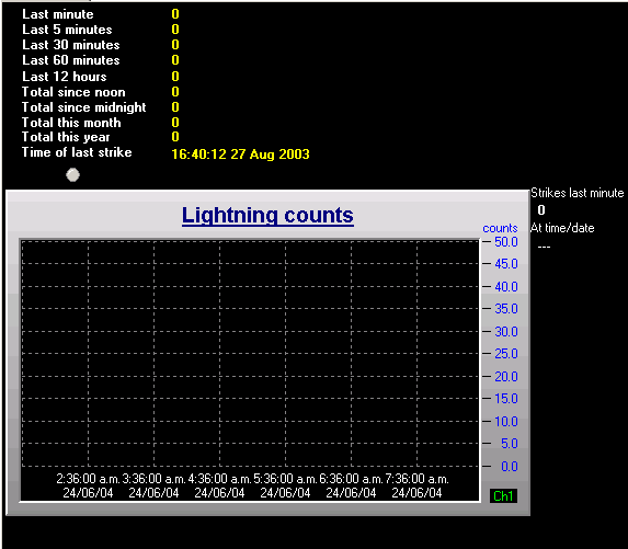
http://www.destin.co.nz/weather/lighteninggraph.gif
shows 155 last 12 hours
the strikes have now scrolled off the graph
(ignore the total since noon number)
bookmark that url
shows 155 last 12 hours
the strikes have now scrolled off the graph
(ignore the total since noon number)
bookmark that url

-
NZ Thunderstorm Soc
- Posts: 18489
- Joined: Wed 12/03/2003 22:08
- Location: Raukapuka Geraldine
- Has thanked: 1769 times
- Been thanked: 1412 times
Hi you lucky people up north.
So, you had a 'feast' overnight !
I was picking up continuous distant sfrerics between 11pm when I got home and they were still going strong when I went to bed just before midnight. They were very very distant tho', I wonder if they were from those storm?
Good pictures Graeme, very NZTS potential shots!!
As Ben said ,it rained overnight with quite strong southerlies blowing with 9.5mm of rain here overnight before clearing up this morning.
Nice and fine now and becoming mild again. Very light SW
JohnGaul
NZTS

-
Michael

- Posts: 7210
- Joined: Thu 27/03/2003 12:04
- Location: Rainy Manurewa, Auckland - "City of Gales"
- Has thanked: 0
- Been thanked: 1 time
- Contact:
[quote="NZ Thunderstorm Soc"]Hi you lucky people up north.
So, you had a 'feast' overnight !
I was picking up continuous distant sfrerics between 11pm when I got home and they were still going strong when I went to bed just before midnight. They were very very distant tho', I wonder if they were from those storm?
Yes they probably were AM travels huge distances due to the ionosphere skywave at night I was trying to get Magic 693 last night and the lightning in addition to the usual interference was wiping it out
-
tich
- Posts: 3472
- Joined: Sat 15/03/2003 18:32
- Location: Christchurch (St Albans)/Akaroa
- Has thanked: 22 times
- Been thanked: 92 times
Only scattered high cloud persisted in the Chch/Banks Peninsula area today, though I could see thicker cloud persisting well to the north. (Kaikoura possibly still wet) The cold southerly overnight did leave a legacy of a fresh dusting of snow on the tops of Banks Peninsula (melted by midafternoon) and on the foothills. I was at Amberley around middday and early afternoon, and there was a white coating on nearby Mt Grey down to about 700-800 metres.
-
NZ Thunderstorm Soc
- Posts: 18489
- Joined: Wed 12/03/2003 22:08
- Location: Raukapuka Geraldine
- Has thanked: 1769 times
- Been thanked: 1412 times
-
Thunder
- Posts: 2068
- Joined: Wed 12/03/2003 19:47
- Location: Mt Somers
- Has thanked: 19 times
- Been thanked: 41 times
WILL DO!
I saw that forcast, what does your opinion say John? You know best!
I remember metservice forcasting thunderstorms once and the day was a brilliant sunny one (brilliant because it was winter and we hadn't had one in a while), you posted a message saying " I feel sorry for all the thunderstorm damage etc people got", obviously you were being sarcastic, it was funny!!
Cheers
Aaron Wilkinson
-
Manukau heads obs
- Posts: 12305
- Joined: Mon 10/03/2003 16:30
- Location: West Coast Road, Manukau Peninsula, North Island
- Has thanked: 0
- Been thanked: 0
- Contact:
met service lightning strikes map for the other night bob mcdavitt sent me
the picture says all!
>Bob McDavitt says that the New Zealand Lightning Detection
> system counted 14,895 cloud-to-ground lightning strikes
> over New Zealand and surrounding seas between dusk on
> Saturday and dawn on Sunday. The number of cloud-to-cloud
> discharges is estimated to be ten times more.
You do not have the required permissions to view the files attached to this post.
-
NZstorm

- Posts: 11333
- Joined: Mon 10/03/2003 19:38
- Location: Grey Lynn, Auckland
- Has thanked: 342 times
- Been thanked: 361 times
Brian, thanks for posting the lightning chart.
Something I have learnt from years of watching thunderstorms is that the cloud to ground strikes occur during the developmental stage of a cumulonimbus. The anvil crawlers(other end of lightning spectrum) come on the declining phase of the cumulonimbus. Anvil crawlers are a form of cloud to cloud lightning.
The storm line was at its peak developmental phase along the west coast, hence all those CG's and declining as it moved eastward hense less CG's. And I had noticed that the storm line had really weakened by the time it got out to sea east of the NI.
-
NZ Thunderstorm Soc
- Posts: 18489
- Joined: Wed 12/03/2003 22:08
- Location: Raukapuka Geraldine
- Has thanked: 1769 times
- Been thanked: 1412 times
I agree Steven. There was nothing here the would stimilate thunderstorm growth this afternoon. NW Arch for most of the afternnon with thick As forms although I did notice virga trails along the Arch plus other forms of instability ie. mammatus and some glaciated cirrus.
I hope Aaron wasn't hopeful/disappointed !!!!
JohnGaul
NZTS
I hope Aaron wasn't hopeful/disappointed !!!!
JohnGaul
NZTS
-
Thunder
- Posts: 2068
- Joined: Wed 12/03/2003 19:47
- Location: Mt Somers
- Has thanked: 19 times
- Been thanked: 41 times
Hi John
Yes I noticed those forms in the NW arch. I wasn't dissapointed that much, my thunderstorm senses just seemed to tell me nothing was going to happen so I'm cool, hehe.
Does anyone here think that South Island West coast thunderstorms would be good to view, for some reason I've always figured they would be a whole lot of sheet lightning, don't know why?
Cheers
Aaron Wilkinson