Storms to herald in '07, Upper NI.
Forum rules
These topics are a read-only archive and may be subject to out-of-date information.
For today's weather discussion head to: New Zealand Weather & Climate
These topics are a read-only archive and may be subject to out-of-date information.
For today's weather discussion head to: New Zealand Weather & Climate
-
Manukau heads obs
- Posts: 12305
- Joined: Mon 10/03/2003 16:30
- Location: West Coast Road, Manukau Peninsula, North Island
- Has thanked: 0
- Been thanked: 0
- Contact:

-
Willoughby

- Site Admin
- Posts: 4433
- Joined: Sat 14/06/2003 16:18
- Location: Darwin, Australia: Storm city
- Has thanked: 264 times
- Been thanked: 288 times
- Contact:
No Cb' visible here, but what a nice morning!  Beats the 5C we had the other night!
Looks like it could be a good day for thunderstorms.. 500mb temps down to -24C today
There is a nice cell developing towards Auckland by the looks from local convergance.. diurnal cooling put a stop to all that convection over Eastland.. but strikes are gathering from there.
Will split this topic now..
-
NZstorm

- Posts: 11333
- Joined: Mon 10/03/2003 19:38
- Location: Grey Lynn, Auckland
- Has thanked: 342 times
- Been thanked: 361 times
Yes, lovely morn in Auckland.
Observed a nice thunderstorm in the Tokoroa area yesterday between about 6pm and 7-30pm. Nice CG's, some IC's streaking across the sky, very heavy rain and hail at times. I was on my way home and passing through Matamata about 5pm saw the convective development to the south and couldn't resist a closer look. The storm was worth the diversion. I havn't looked at my photos yet but may put a few up shortly.
Observed a nice thunderstorm in the Tokoroa area yesterday between about 6pm and 7-30pm. Nice CG's, some IC's streaking across the sky, very heavy rain and hail at times. I was on my way home and passing through Matamata about 5pm saw the convective development to the south and couldn't resist a closer look. The storm was worth the diversion.
-
Manukau heads obs
- Posts: 12305
- Joined: Mon 10/03/2003 16:30
- Location: West Coast Road, Manukau Peninsula, North Island
- Has thanked: 0
- Been thanked: 0
- Contact:
-
Willoughby
- Site Admin
- Posts: 4433
- Joined: Sat 14/06/2003 16:18
- Location: Darwin, Australia: Storm city
- Has thanked: 264 times
- Been thanked: 288 times
- Contact:
-
kaimaikid
- Posts: 233
- Joined: Fri 25/03/2005 19:57
- Location: Tauranga
- Has thanked: 0
- Been thanked: 0
- Contact:
Latest Met TS info...
Valid to: 12:00 am 2 Jan 2007 NZDT
Issued at: 8:29 am 1 Jan 2007 NZDT
The atmosphere remains unstable over much of the country today. However, there are some preventative factors at work over the North Island (such as cloud cover). There is still a low risk of thunderstorms about the northern Gisborne ranges, the Bay of Plenty, much of Waikato, the Coromandel Peninsula, and about the Hunua Ranges. Small hail, and localised heavy rain of 10-20mm per hour could occur with any thunderstorms.
In the South Island, there is a moderate risk of thunderstorms again today about the ranges of Nelson, with hail of 10-20mm diameter, and localised heavy falls of 10-25mm per hour. A lower risk of thunderstorms surrounds this area, and extends southwards to the Buller ranges.
No thunderstorms are expected elsewhere.
You do not have the required permissions to view the files attached to this post.
-
Willoughby
- Site Admin
- Posts: 4433
- Joined: Sat 14/06/2003 16:18
- Location: Darwin, Australia: Storm city
- Has thanked: 264 times
- Been thanked: 288 times
- Contact:

-
NZstorm
- Posts: 11333
- Joined: Mon 10/03/2003 19:38
- Location: Grey Lynn, Auckland
- Has thanked: 342 times
- Been thanked: 361 times
I could hear the roar of the hail from my veranda for several minutes before we had a drop of rain here.
Sunny here now with t/cu cb's to N/NE and SE.
Sunny here now with t/cu cb's to N/NE and SE.
Last edited by NZstorm on Mon 01/01/2007 10:47, edited 1 time in total.

-
spwill
- Posts: 9918
- Joined: Sun 29/06/2003 22:39
- Location: Mt Eden Auckland
- Has thanked: 847 times
- Been thanked: 869 times
We had a light white coating of hail through Mt Eden. Much of the Hail was pea size and smaller but the odd bigger stone up to 1.5cm as in Photo.
You do not have the required permissions to view the files attached to this post.
Last edited by spwill on Mon 01/01/2007 11:18, edited 1 time in total.
-
Willoughby
- Site Admin
- Posts: 4433
- Joined: Sat 14/06/2003 16:18
- Location: Darwin, Australia: Storm city
- Has thanked: 264 times
- Been thanked: 288 times
- Contact:
MetService talk about the inhibiting cloud cover.. but there's not that much around really.. just some altocumulus about.
Of course, when we chased 2 weeks ago it was all forecasted to strike around BoP/Coromandel but ended straight thru Waikato/eastern Auckland.
May go chasing today with Gary.. anyone else in?
Of course, when we chased 2 weeks ago it was all forecasted to strike around BoP/Coromandel but ended straight thru Waikato/eastern Auckland.
May go chasing today with Gary.. anyone else in?

-
Willoughby
- Site Admin
- Posts: 4433
- Joined: Sat 14/06/2003 16:18
- Location: Darwin, Australia: Storm city
- Has thanked: 264 times
- Been thanked: 288 times
- Contact:
-
Manukau heads obs
- Posts: 12305
- Joined: Mon 10/03/2003 16:30
- Location: West Coast Road, Manukau Peninsula, North Island
- Has thanked: 0
- Been thanked: 0
- Contact:
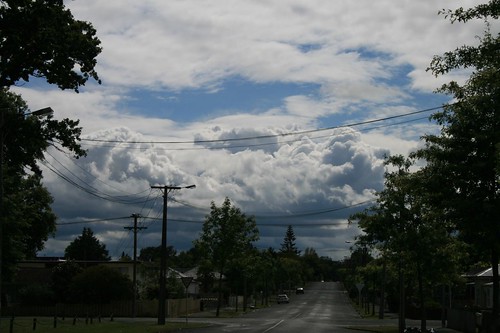
beautiful CB line now stretching from just east of aucland city southwards
lots of strikes being picked up now
i have some photos to get up..
first photo is the cb firing off right now
lots of strikes being picked up now
i have some photos to get up..
first photo is the cb firing off right now
You do not have the required permissions to view the files attached to this post.
Last edited by Manukau heads obs on Mon 01/01/2007 16:34, edited 2 times in total.
-
Willoughby
- Site Admin
- Posts: 4433
- Joined: Sat 14/06/2003 16:18
- Location: Darwin, Australia: Storm city
- Has thanked: 264 times
- Been thanked: 288 times
- Contact:
-
Willoughby
- Site Admin
- Posts: 4433
- Joined: Sat 14/06/2003 16:18
- Location: Darwin, Australia: Storm city
- Has thanked: 264 times
- Been thanked: 288 times
- Contact:
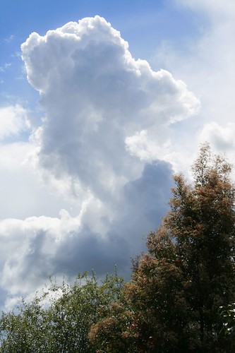
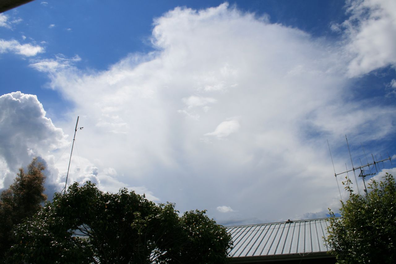
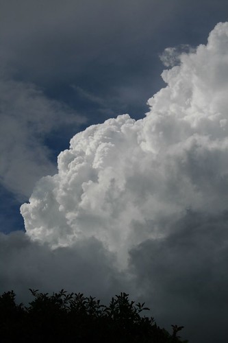
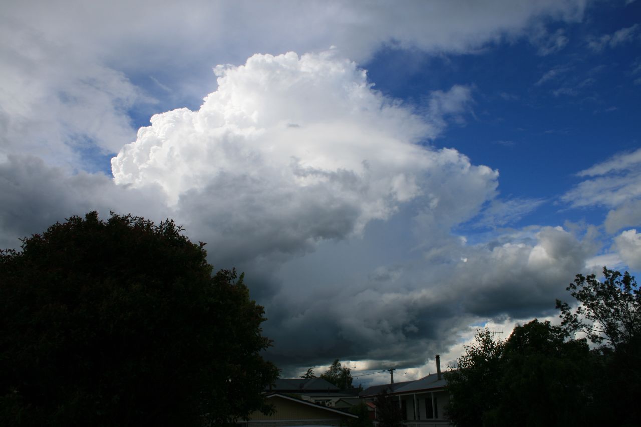
Looks south 10mins ago:
North.. thundery Cb

Zoom in:
http://www.hamiltonweather.co.nz/lightn ... rmVue.html
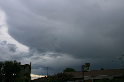
Getting active! Raining here now. Reports of hail from Rotorua!
North.. thundery Cb
Zoom in:
http://www.hamiltonweather.co.nz/lightn ... rmVue.html
Getting active! Raining here now. Reports of hail from Rotorua!