Observed thunder/lightning and heavy rain near Mercer just south of the Bombay hills on SH 1 this Afternoon. Two storms developed in the area as I arrived . They drifted NE into the Hill country (Hanua) so I gave up the chase.
Nice pics above so I wont post mine.
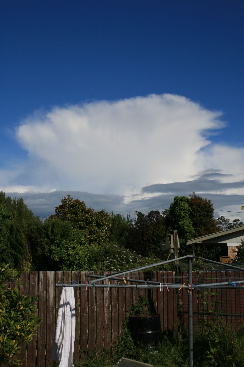
Storms to herald in '07, Upper NI.
Forum rules
These topics are a read-only archive and may be subject to out-of-date information.
For today's weather discussion head to: New Zealand Weather & Climate
These topics are a read-only archive and may be subject to out-of-date information.
For today's weather discussion head to: New Zealand Weather & Climate
-
Razor
- Moderator
- Posts: 5134
- Joined: Fri 10/02/2006 15:14
- Location: Halswell, Christchurch
- Has thanked: 719 times
- Been thanked: 930 times
Heres a few pics courtesy of my cellphone...came out pretty well.
First two from Titirangi, last two from Ellerslie. Looked to be some really interesting downdraft type stuff going on from the motorway!
First two from Titirangi, last two from Ellerslie. Looked to be some really interesting downdraft type stuff going on from the motorway!
You do not have the required permissions to view the files attached to this post.
Christchurch Rocks
-
tgsnoopy

- Posts: 3653
- Joined: Fri 25/03/2005 21:17
- Location: Tauranga, NZ (Curse you COVID-19 :-( )
- Has thanked: 816 times
- Been thanked: 283 times
Had an excellent late afternoon chase through the Katikati to Tauranga area. Things really started going off from about 3pm with lots of CG action, quite impressive to watch whilst driving down the Kaimais.
One thing I did notice was Gary's Boltek may be ranging slightly close, Foggy's seemed to be blind or it is rotated about 20° out (to the left). Maybe the Kaimai ranges were causing it trouble?
The heavy rain/hail bands slowed SH2 down to a crawl and we had several inches of small hail on the ground when we cleared the downpour.
Sorry, I was driving, hopefully my passenger took some photos.
Hopefully more tomorrow
-
Storm Struck

- Posts: 4868
- Joined: Wed 17/11/2004 21:25
- Location: Belfast Christchurch
- Has thanked: 23 times
- Been thanked: 376 times
What a start to 2007 then with some nice structured pics on the forum well done guys good to see.
Does anyone actually video tape the storms up north? or is it just us canty chasers
 .
.
By the way looking ok for possible thunder over inland canty plains etc on thursday afternoon especially with the wind being NE a change in current to the several days of cold SW winds should mix in well.
Possibly a simular scene to the 18th of december 06.
Cheers
Jason.
Does anyone actually video tape the storms up north? or is it just us canty chasers
By the way looking ok for possible thunder over inland canty plains etc on thursday afternoon especially with the wind being NE a change in current to the several days of cold SW winds
Possibly a simular scene to the 18th of december 06.
Cheers
Jason.
Canterbury, home of good rugby and severe storms

-
GraemeWi
- Posts: 1012
- Joined: Sun 30/03/2003 18:28
- Location: Hobsonville Point, Auckland
- Has thanked: 36 times
- Been thanked: 78 times
- Contact:
I've got a video camera and a firewire capture, but normal digital photography is much quicker and easier for me to use and easier to share online.Jasestrm wrote: Does anyone actually video tape the storms up north? or is it just us canty chasers
In say 5mb of bandwidth I can share maybe 25 or more good static images maybe 800 x 600 resolution vs a few seconds of highly compressed video footage the size of a postage stamp
Cheers,
G
-
tgsnoopy
- Posts: 3653
- Joined: Fri 25/03/2005 21:17
- Location: Tauranga, NZ (Curse you COVID-19 :-( )
- Has thanked: 816 times
- Been thanked: 283 times
I tried the video camera with Foggy early last year. Unfortunately the footage wasn't much use (autofocusing on the windscreen etc).
If I wasn't driving I guess some better results could be obtained, but I like driving through the hail with lightning above and around us too much. Nothing quite like watching others who can't see struggle to drive whilst my rain X keeps my visibility up without needing to use the wipers.
Maybe I should just fit the camera to a mount in the car set the focus to manual and infinity and leave it running? Who know's might even get a chance this afternoon? [Fingers Crossed]
-
NZstorm

- Posts: 11333
- Joined: Mon 10/03/2003 19:38
- Location: Grey Lynn, Auckland
- Has thanked: 342 times
- Been thanked: 361 times
I have used movie mode on my Canon G5 compact camera before. I have a couple of good movies of frequent lightning in the USA. I have thought about putting them on You Tube but never got round to it. I didn't think to use my G5 movie mode on the Tokoroa storm as I was using the 400D which doesn't have movie mode.
Apart from a low risk of a sea breeze convergence storm over the BOP/Coromandal today, looks like NZ is in for an extended period of settled weather as a big cold anticyclone moves in for an extended stay.
Apart from a low risk of a sea breeze convergence storm over the BOP/Coromandal today, looks like NZ is in for an extended period of settled weather as a big cold anticyclone moves in for an extended stay.
-
NZstorm
- Posts: 11333
- Joined: Mon 10/03/2003 19:38
- Location: Grey Lynn, Auckland
- Has thanked: 342 times
- Been thanked: 361 times
I think USA storms with the continuous lightning and strong rotation/tornadoes are best captured by video. The more sedate NZ storms are effectively documented with the SLR camera.
A wall cloud (mesocyclone) photo looks nothing as a still photo but in video they are quite impressive.
Thinking of getting a video camera. I notice the Sony HDR has dropped in price considerably in the past year. Sony perhaps make the best video for storm chasing as they perform well in low light situations.
Last edited by NZstorm on Tue 02/01/2007 11:15, edited 1 time in total.
-
Manukau heads obs
- Posts: 12305
- Joined: Mon 10/03/2003 16:30
- Location: West Coast Road, Manukau Peninsula, North Island
- Has thanked: 0
- Been thanked: 0
- Contact:
i have a new sony handycam (digital VD) for the USA trip now
nice photo kaimai kid!
up close and personal!
for a video of yesterdays clouds (the best were off to the right of my webcam though):
http://www.weather-display.com/windy/gb ... yvideo.htm
nice photo kaimai kid!
up close and personal!
for a video of yesterdays clouds (the best were off to the right of my webcam though):
http://www.weather-display.com/windy/gb ... yvideo.htm

-
Willoughby

- Site Admin
- Posts: 4433
- Joined: Sat 14/06/2003 16:18
- Location: Darwin, Australia: Storm city
- Has thanked: 264 times
- Been thanked: 288 times
- Contact:
It was most likely blind due to the storm trac targets Nexstorm plots, where it 'focuses' on putting the strikes there with a cell.One thing I did notice was Gary's Boltek may be ranging slightly close, Foggy's seemed to be blind or it is rotated about 20° out (to the left). Maybe the Kaimai ranges were causing it trouble?
I probably had my ranging a little too far where Gary had his too close as you say.
Here's my comparasion for 5pm...
You do not have the required permissions to view the files attached to this post.
-
Manukau heads obs
- Posts: 12305
- Joined: Mon 10/03/2003 16:30
- Location: West Coast Road, Manukau Peninsula, North Island
- Has thanked: 0
- Been thanked: 0
- Contact:
-
Willoughby
- Site Admin
- Posts: 4433
- Joined: Sat 14/06/2003 16:18
- Location: Darwin, Australia: Storm city
- Has thanked: 264 times
- Been thanked: 288 times
- Contact: