64 (118kmh)knots at Manukau heads signal station now
also gusting to over 60 knots at channel island too

OT here...NZ Thunderstorm Soc wrote:Use English spelling please on this forum, I get offended by USA spellingCaptain K wrote:This photo appeals to my sense of humor! A friend of mine took it this morning in the Kauaeranga Valley near Thames. There is a ford under this wee bit of water that at usual height, is only about 3 inches high!
JohnGaul
NZTS


'Mini-tornado causes major damage'
5:00AM Thursday July 31, 2008 - By Juliet Rowan
...The man said the twister was about three-quarters of the width of the two-lane road, and was carrying letter boxes and rubbish.
The MetService said the twister could be classified as a mini-tornado because it was not as large as a full-scale tornado, and had been generated by strong wind off the coast. ...
Try the other thread mateVertigo wrote:so, whats happening with the storm? havent heard much from the southerners!
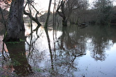
need some photos please - passed through there last week in the truck and the river was looking more like a lake...j--me--h wrote:Bah i hate that word
Waikato River still rising at a fast rate. With heavy showers turning to more widespread rain in the area forecast today, that should help it have a higher peak. Might go for a drive do to Mercer this afternoon. I have now idea when it will be at its heighest though. Ill just have to keep watch online.
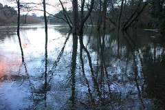
Yep ill have my camera for sure.kaimaikid wrote:need some photos please - passed through there last week in the truck and the river was looking more like a lake...j--me--h wrote:Bah i hate that word
Waikato River still rising at a fast rate. With heavy showers turning to more widespread rain in the area forecast today, that should help it have a higher peak. Might go for a drive do to Mercer this afternoon. I have now idea when it will be at its heighest though. Ill just have to keep watch online.