Unstable squally western NZ 11-15th July
Forum rules
These topics are a read-only archive and may be subject to out-of-date information.
For today's weather discussion head to: New Zealand Weather & Climate
These topics are a read-only archive and may be subject to out-of-date information.
For today's weather discussion head to: New Zealand Weather & Climate
-
jamie
- Posts: 5907
- Joined: Fri 25/02/2011 21:35
- Location: Hamilton NZ
- Has thanked: 22 times
- Been thanked: 273 times
- Contact:
Re: Unstable squally western NZ 11-12th July
That was a good squall that just came thru. Some rather heavy rain to it. No hail tho which suprised me
Re: Unstable squally western NZ 11-12th July
Really heavy shower here now
Just as i was typing this it ended
Just as i was typing this it ended
-
jamie
- Posts: 5907
- Joined: Fri 25/02/2011 21:35
- Location: Hamilton NZ
- Has thanked: 22 times
- Been thanked: 273 times
- Contact:
Re: Unstable squally western NZ 11-12th July
Thunder here. Must be about 5 days in a row i have heard thunder thunder.
-
Manukau heads obs
- Posts: 12305
- Joined: Mon 10/03/2003 16:30
- Location: West Coast Road, Manukau Peninsula, North Island
- Has thanked: 0
- Been thanked: 0
- Contact:
Re: Unstable squally western NZ 11-12th July
just seen lightning out to sea
getting windy again...gusting to 50 knots...
getting windy again...gusting to 50 knots...

-
NZstorm

- Posts: 11333
- Joined: Mon 10/03/2003 19:38
- Location: Grey Lynn, Auckland
- Has thanked: 342 times
- Been thanked: 361 times
Re: Unstable squally western NZ 11-12th July
I saw a flash out to WSW.
Notice the dp has come up to 10C, from 7-8C this afternoon.
Notice the dp has come up to 10C, from 7-8C this afternoon.
-
Manukau heads obs
- Posts: 12305
- Joined: Mon 10/03/2003 16:30
- Location: West Coast Road, Manukau Peninsula, North Island
- Has thanked: 0
- Been thanked: 0
- Contact:
Re: Unstable squally western NZ 11-12th July
Sent the thunder and lightning up here please! And please don't forget the hail!
Had 6.35mm of these short sharp showers. Max wind today so far is 43.9kph.
Had 6.35mm of these short sharp showers. Max wind today so far is 43.9kph.

-
Manukau heads obs
- Posts: 12305
- Joined: Mon 10/03/2003 16:30
- Location: West Coast Road, Manukau Peninsula, North Island
- Has thanked: 0
- Been thanked: 0
- Contact:
Re: Unstable squally western NZ 11-12th July
papakura area in the firing line again...
amazingly the peak of this CB passed just 2km to the south of me...same place as the one last night....
amazingly the peak of this CB passed just 2km to the south of me...same place as the one last night....
-
Vertigo

- Posts: 1184
- Joined: Sun 09/12/2007 23:50
- Location: Henderson, Auckland
- Has thanked: 0
- Been thanked: 12 times
Re: Unstable squally western NZ 11-12th July
saw a strike over henderson way or beyond, in a line from beachaven
-
jamie
- Posts: 5907
- Joined: Fri 25/02/2011 21:35
- Location: Hamilton NZ
- Has thanked: 22 times
- Been thanked: 273 times
- Contact:
Re: Unstable squally western NZ 11-12th July
DP and temp rising? whats going on? im at 13C and 11DP right now. is there going to be yet another front to come?
-
Manukau heads obs
- Posts: 12305
- Joined: Mon 10/03/2003 16:30
- Location: West Coast Road, Manukau Peninsula, North Island
- Has thanked: 0
- Been thanked: 0
- Contact:
Re: Unstable squally western NZ 11-12th July
same thing where, its back up to 12.8C hereDP and temp rising? whats going on? im at 13C and 11DP right now. is there going to be yet another front to come?
but no real sign of another front on the sat map, except down taranaki way...
just a flow tending more westerly again in the tasman
big rain clouds moving across Aus at the moment...what going to happen to that once it hits the tasman?
-
Nev

- Moderator
- Posts: 6229
- Joined: Tue 07/03/2006 15:24
- Location: Waiheke Island, Hauraki Gulf
- Has thanked: 474 times
- Been thanked: 1073 times
Re: Unstable squally western NZ 11-12th July
Thought it might be an idea to create separate threads for the 2 events recently reported as 'tornadoes'. Note that some posts from here have been moved to this thread.
-
Tornado Tim

- Moderator
- Posts: 4920
- Joined: Sun 19/10/2008 17:17
- Location: Raglan, Waikato / Hillcrest, Hamilton
- Has thanked: 102 times
- Been thanked: 202 times
- Contact:
Re: Unstable squally western NZ 11-12th July
Had a fairly heavy squally shower come through last night at 2 AM up to 108mm/hr at one time.
As Jamie mentioned in the July Thread, the ground cant absorb much more water.
16.2mm so far today (midnight reset)
As Jamie mentioned in the July Thread, the ground cant absorb much more water.
16.2mm so far today (midnight reset)
NZAPStrike.net - NZ Aus Pacific Strike Network
-
GreggWard
- Posts: 434
- Joined: Wed 12/03/2003 22:09
- Location: Palmerston North
- Has thanked: 160 times
- Been thanked: 5 times
Re: Unstable squally western NZ 11-12th July
Have just had two thunderstorms pass over and to the N of Palmerston North, in the last hour. The lightning was only every three to five minutes, but was mostly CG lightning. It seemed to have a pinkish tinge to it.
-
jamie
- Posts: 5907
- Joined: Fri 25/02/2011 21:35
- Location: Hamilton NZ
- Has thanked: 22 times
- Been thanked: 273 times
- Contact:
Re: Unstable squally western NZ 11-12th July
A couple of days past the title I know but just got woken by some amazing thunder that went on and on. Fitted well with my dream of me being in a war. Great sound effects haha.
Almost like American movies where the thunder hits and then the rain starts pouring. Exactly that here
Dang that was a super super quick 7mm
Almost like American movies where the thunder hits and then the rain starts pouring. Exactly that here
Dang that was a super super quick 7mm
-
Tornado Tim
- Moderator
- Posts: 4920
- Joined: Sun 19/10/2008 17:17
- Location: Raglan, Waikato / Hillcrest, Hamilton
- Has thanked: 102 times
- Been thanked: 202 times
- Contact:
Re: Unstable squally western NZ 11-12th July
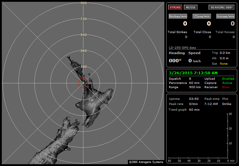
A steady increase in lightning now going by the bolteks 
NZAPStrike.net - NZ Aus Pacific Strike Network
-
Manukau heads obs
- Posts: 12305
- Joined: Mon 10/03/2003 16:30
- Location: West Coast Road, Manukau Peninsula, North Island
- Has thanked: 0
- Been thanked: 0
- Contact:
Re: Unstable squally western NZ 11-12th July
thunder heard here!
my boltec is tracking 2 cells heading my way
my boltec is tracking 2 cells heading my way
-
Tornado Tim
- Moderator
- Posts: 4920
- Joined: Sun 19/10/2008 17:17
- Location: Raglan, Waikato / Hillcrest, Hamilton
- Has thanked: 102 times
- Been thanked: 202 times
- Contact:
Re: Unstable squally western NZ 11-12th July
Your ftp doesnt seem to be working Brian for your lightning data....Manukau heads obs wrote:thunder heard here!
my boltec is tracking 2 cells heading my way
NZAPStrike.net - NZ Aus Pacific Strike Network
-
Tornado Tim
- Moderator
- Posts: 4920
- Joined: Sun 19/10/2008 17:17
- Location: Raglan, Waikato / Hillcrest, Hamilton
- Has thanked: 102 times
- Been thanked: 202 times
- Contact:
Re: Unstable squally western NZ 11-12th July
owh, Severe T-storm Warning for Port Waikato:
SEVERE THUNDERSTORM WARNING
TOP PRIORITY FOR IMMEDIATE BROADCAST
Issued by MetService at 07:05 am Thursday 14 July 2011.
Valid until 07:52 am Thursday 14 July 2011.
This warning affects people in the following local government areas:
FRANKLIN.
At 06:52 am, MetService weather radar detected severe thunderstorms near OFFSHORE PORT WAIKATO.
These severe thunderstorms are moving towards the eastsoutheast, and are expected to lie near PORT WAIKATO, TE KOHANGA and ONEWHERO at 07:22 am and are expected to have dissipated by 07:52 am.
These thunderstorms are expected to be accompanied by very heavy rain, large hail and damaging wind gusts.
Very heavy rain can cause surface and/or flash flooding about streams, gullies and urban areas, and make driving conditions extremely hazardous.
Large hail can cause significant damage to crops, orchards, vines, glasshouses and vehicles, and make driving conditions hazardous.
Very strong wind gusts can break branches from trees, damage roofing, and make driving hazardous especially for high-sided vehicles and motorcycles.
The Ministry of Civil Defence and Emergency Management advises that as storms approach you should:
- Take shelter, preferably indoors away from windows;
- Avoid sheltering under trees, if outside;
- Move cars under cover or away from trees;
- Secure any loose objects around your property;
- Check that drains and gutters are clear;
- Be ready to slow down or stop, if driving.
During and after the storm, you should also:
- Beware of fallen trees and power lines;
- Avoid streams and drains as you may be swept away in flash flooding.
This warning is due to be updated or lifted by 07:52 am Thursday 14 July 2011.
NOTE: Only severe thunderstorm tracks are shown in the graphic. Other thunderstorms may exist in the area.
MEDIA PLEASE NOTE: This warning will be updated within the next hour or so. MetService would appreciate it being broadcast regularly during this period
You do not have the required permissions to view the files attached to this post.
NZAPStrike.net - NZ Aus Pacific Strike Network
-
jamie
- Posts: 5907
- Joined: Fri 25/02/2011 21:35
- Location: Hamilton NZ
- Has thanked: 22 times
- Been thanked: 273 times
- Contact:
Re: Unstable squally western NZ 11-12th July
picking up heaps of lightning to my NW and hearing a constant low rumble. Surprised to see that was severe warned earlier
-
Manukau heads obs
- Posts: 12305
- Joined: Mon 10/03/2003 16:30
- Location: West Coast Road, Manukau Peninsula, North Island
- Has thanked: 0
- Been thanked: 0
- Contact:
Re: Unstable squally western NZ 11-12th July
uploads are working Tim
http://www.weather-display.com/windy/gb/screenshot.png
http://www.weather-display.com/windy/gb/StormVue.html
I could see the lightning from that port waikato strom this morning
its the CB out to my NW that is the next one
they are being enhanced by the jet stream that moved over australia yesterday that I mentioned
(you can see towers with their snout in the jet stream cloud)
-
Tornado Tim
- Moderator
- Posts: 4920
- Joined: Sun 19/10/2008 17:17
- Location: Raglan, Waikato / Hillcrest, Hamilton
- Has thanked: 102 times
- Been thanked: 202 times
- Contact:
Re: Unstable squally western NZ 11-12th July
Cool, Thanks Brian
Your static screenshot on your site was linking to this: http://www.weather-display.com/windy/gb/nexstorm.png
Your static screenshot on your site was linking to this: http://www.weather-display.com/windy/gb/nexstorm.png
NZAPStrike.net - NZ Aus Pacific Strike Network
-
Manukau heads obs
- Posts: 12305
- Joined: Mon 10/03/2003 16:30
- Location: West Coast Road, Manukau Peninsula, North Island
- Has thanked: 0
- Been thanked: 0
- Contact:
-
NZstorm
- Posts: 11333
- Joined: Mon 10/03/2003 19:38
- Location: Grey Lynn, Auckland
- Has thanked: 342 times
- Been thanked: 361 times
Re: Unstable squally western NZ 11-12th July
I agree Brian, the jet stream is the key ingredient there this morning.