Page 5 of 6
Cold Snap 18-22 September 2015
Posted: Sun 20/09/2015 20:56
by jamie
Yea strange that there is no heavy rain warning in place for south Waikato. A lot more to fall by the looks. Already had enough to constitute a warning.
We have a house vibrating in the SE wind. Really whistling and thumping.
Cold Snap 18-22 September 2015
Posted: Sun 20/09/2015 21:01
by jamie
Oh they have now released one.
Re: Cold Snap 18-22 September 2015
Posted: Sun 20/09/2015 21:07
by Manukau heads obs
good stuff.was that a mixture of rain and hail in Te Awamutu?..as that was how it ended up like with that storm at Ramarama as well
Re: Cold Snap 18-22 September 2015
Posted: Sun 20/09/2015 21:08
by NZstorm
great clips. thanks for postng.
Re: Cold Snap 18-22 September 2015
Posted: Sun 20/09/2015 21:14
by brikrip
Heavy Rain at start then constant pea size hail for 15min heavy rain most of day since then Enviro waikato rainfall for Te awamutu upto 97mm since midnight
Re: Cold Snap 18-22 September 2015
Posted: Sun 20/09/2015 21:29
by spwill
A couple more photos, hail on the road & developing shower clouds.
All the showers I drove through today had hail.
Re: Cold Snap 18-22 September 2015
Posted: Sun 20/09/2015 23:30
by Thunder081
Re: Cold Snap 18-22 September 2015
Posted: Mon 21/09/2015 06:46
by NZstorm
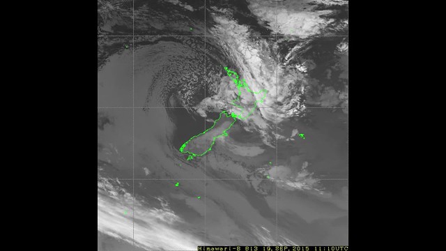
12Z run of the gfs looking to favour some afternoon convection Tuesday over the west of the North Island.
Have to see how things pan out though. A few thunderstorms/small hail possible between Auckland and Waitomo.
midday 500mb chart
Re: Cold Snap 18-22 September 2015
Posted: Mon 21/09/2015 10:54
by spwill
Maybe a southwest breeze tomorrow will keep any afternoon shower development east of here
Re: Cold Snap 18-22 September 2015
Posted: Mon 21/09/2015 12:01
by Razor
Metservice (and Tony

) modelling 40-50mm of rain in the next 48 hours, with more to follow after. That's a serious situation potentially for Christchurch post quake
Re: Cold Snap 18-22 September 2015
Posted: Mon 21/09/2015 12:28
by TonyT
Razor wrote:Metservice (and Tony
) modelling 40-50mm of rain in the next 48 hours, with more to follow after. That's a serious situation potentially for Christchurch post quake
No no, yesterday's data suggested that, today's is much lower.10-20mm.
Re: Cold Snap 18-22 September 2015
Posted: Mon 21/09/2015 14:19
by Razor
TonyT wrote:Razor wrote:Metservice (and Tony
) modelling 40-50mm of rain in the next 48 hours, with more to follow after. That's a serious situation potentially for Christchurch post quake
No no, yesterday's data suggested that, today's is much lower.10-20mm.
Oh? Just going off Metservice and Farmlands sites...must have been prior to an update

Good news
Re: Cold Snap 18-22 September 2015
Posted: Mon 21/09/2015 14:53
by Richard
Thats bad news, i'm starting to wonder if we will get any rain at all from this system
Re: Cold Snap 18-22 September 2015
Posted: Mon 21/09/2015 14:56
by Razor
Richard wrote:Thats bad news, i'm starting to wonder if we will get any rain at all from this system
Looking at the 3 day metservice maps you'll be getting plenty this time mate
Re: Cold Snap 18-22 September 2015
Posted: Mon 21/09/2015 15:06
by Manukau heads obs
what will hopefully happen Richard, and its allready starting, is that all that sub tropical moisture/cloud mass that spireled down around the low and ended up near the Chatham islands, will end up getting shunted onto eastern SI from CHCH north tomorrow, in the easterly flow
Re: Cold Snap 18-22 September 2015
Posted: Mon 21/09/2015 15:09
by Razor
Yes, its been wet again in ChCh since lunchtime today
Posted: Mon 21/09/2015 15:20
by melja
Sunny spell's north of Christchurch this afternoon.
M/S has really pulled back on the heavy rain in this afternoons SW outlook.
Re:
Posted: Mon 21/09/2015 15:33
by Razor
melja wrote:Sunny spell's north of Christchurch this afternoon.
M/S has really pulled back on the heavy rain in this afternoons SW outlook.
And yet their 48 hour chart still plugs for 50mm +
Re: Cold Snap 18-22 September 2015
Posted: Mon 21/09/2015 15:35
by Richard
Razor wrote:Richard wrote:Thats bad news, i'm starting to wonder if we will get any rain at all from this system
Looking at the 3 day metservice maps you'll be getting plenty this time mate
I hope you are right, ... just watching a truck go by with clouds of dust behind it

Re: Cold Snap 18-22 September 2015
Posted: Mon 21/09/2015 16:32
by Wildland
The flooding in the Gisborne district looks serious.
The drone footage in the attached Stuff article shows that the three rivers in the centre of Gisborne City are now well above their normal channels. The business part of the city is protected by higher banks at the three river junction, but lower lying areas on the other side are starting to get swamped.
http://www.stuff.co.nz/dominion-post/ne ... east-coast
Re: Cold Snap 18-22 September 2015
Posted: Mon 21/09/2015 18:32
by NZ Thunderstorm Soc
Yes, with all that rain around the Gisborne /Hawkes Bay area, looks like any idea of reinstating the rail link to Gisborne is a 'gone-burger'

Re: Cold Snap 18-22 September 2015
Posted: Mon 21/09/2015 20:36
by NZ Thunderstorm Soc
Nice clear and calm skies at the moment, looks like we're heading for a frost, down to 0.5C at the moment.
Shame the Aurora wasn't tonight although the moon is filling out and making things brighter.
Direct contrast to MetService's forecast of cloud and occasional drizzle, although that could come through later.
Nice looking convergence line to the east just before sunset.
Re: Cold Snap 18-22 September 2015
Posted: Mon 21/09/2015 21:09
by josholiver657
Hello all, nice to be back after a wee break from the weather. I am going back to how it was before I started CWU, so I will be following all events with interest, as a hobby only. If I have unintentionally offended anyone on here please accept my apology, no hard feelings I hope.
I am getting interested in what could potentially happen in about 24 hours time for ChCh, could be a good 40-50mm for us between midday tomorrow and even into Thursday as the drizzle stuff continues. And good news for the dry parts of North Canty (inland) looks to be some good rain on the way for you guys too!
Re: Cold Snap 18-22 September 2015
Posted: Mon 21/09/2015 21:21
by Tornado Tim
Cold upper level trough moving in over the Waikato tomorrow afternoon. Wind Convergence combined should be sufficient to get quite few isolated storms over Waikato to South Auckland.
Screen Shot 2015-09-21 at 9.00.00 PM.png
Update: Seems that Metservice have a similar outlook.
Updated at 8:25pm Monday - Risk areas expanded to include parts of Taranaki. Risk of significant hail accumulation added.
The combination of cold temperatures aloft, lightish winds and afternoon heating are expected to produce scattered showers and a few thunderstorms over the central and northern North Island on Tuesday afternoon and early evening.
The main risk of thunderstorms extends from Auckland to northern Taranaki and western Bay of Plenty, with a lower risk covering surrounding areas as indicated on the chart. These thunderstorms will be accompanied by localised heavy rain of 10-20mm/hr, and hail in the 5-15mm diameter range. As the thunderstorms are likely to be slow-moving, it is possible there could be significant hail accumulation in some places, which could cause damage to crops and make driving conditions hazardous.
No other thunderstorms or significant convection expected over New Zealand on Tuesday afternoon and evening.
Re: Cold Snap 18-22 September 2015
Posted: Mon 21/09/2015 22:54
by NZ Thunderstorm Soc
Richard wrote:Thats bad news, i'm starting to wonder if we will get any rain at all from this system
Sad to say this Richard, but judging from tonight's clear weather and frosty conditions, which MetService didn't say, directly for tonight, looks like it will be a mostly drizzly scenario for eager SI areas unless a very active ULT moves across ?