Convective Possibilities, North Island - 9,10,11 Feb 07
Forum rules
These topics are a read-only archive and may be subject to out-of-date information.
For today's weather discussion head to: New Zealand Weather & Climate
These topics are a read-only archive and may be subject to out-of-date information.
For today's weather discussion head to: New Zealand Weather & Climate
-
GreggWard
- Posts: 434
- Joined: Wed 12/03/2003 22:09
- Location: Palmerston North
-
Willoughby

- Site Admin
- Posts: 4443
- Joined: Sat 14/06/2003 16:18
- Location: Darwin, Australia: Storm city
-
Paul Mallinson
- Meteorologist (Retired)
- Posts: 406
- Joined: Thu 27/10/2005 20:44
- Location: Greytown
I'm home now.
Sure looks like things are hummin.
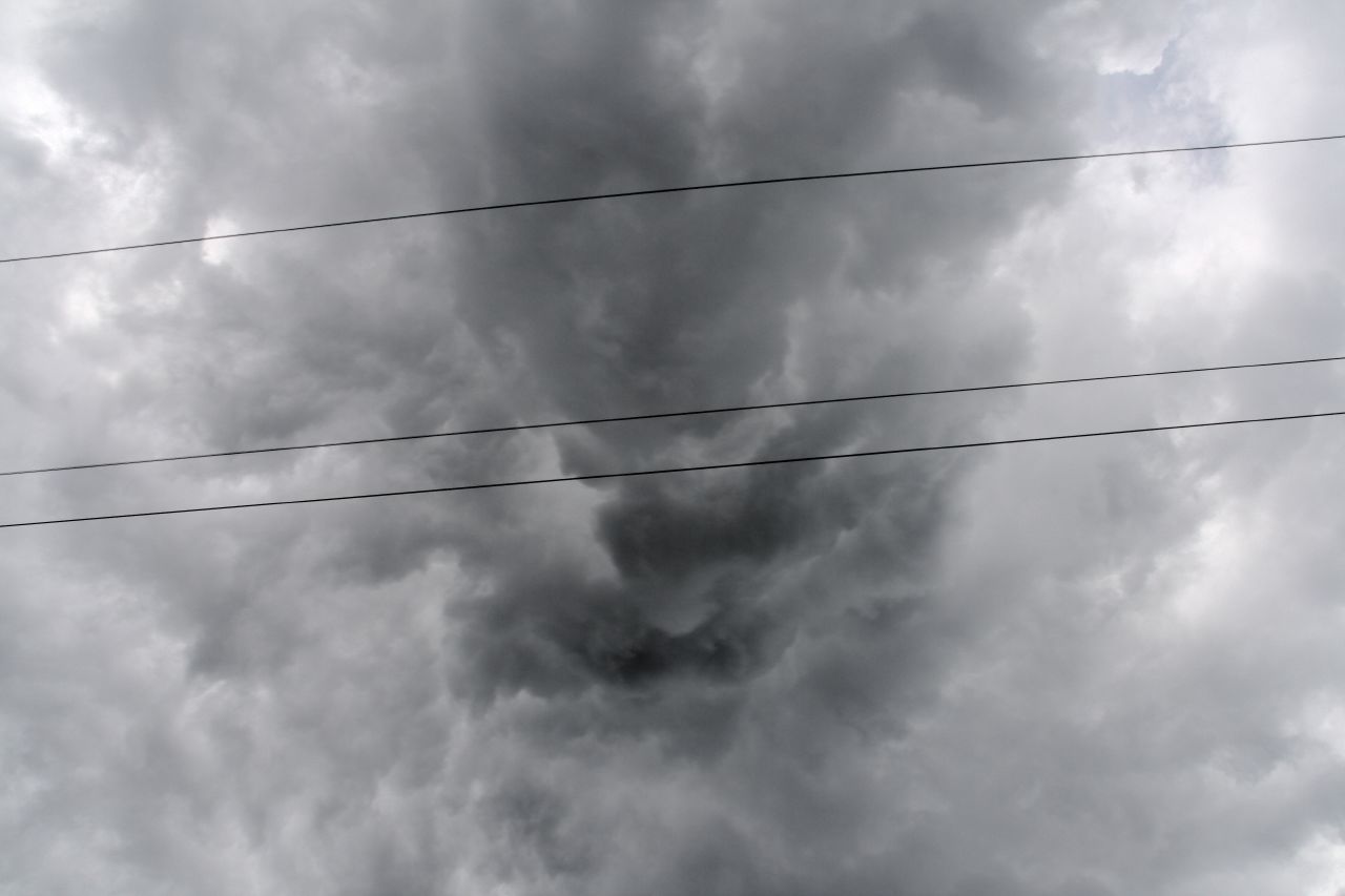
That last pic of yours Foggy is an especially interesting on. I think we are seeing the CB going up through the Pileus Cap cloud around the top edges of the storm. Most often we see this from the side as Brian showed yesterday I think it was in one of his pics - whereas this is a shot from below.
Paul
Sure looks like things are hummin.
That last pic of yours Foggy is an especially interesting on. I think we are seeing the CB going up through the Pileus Cap cloud around the top edges of the storm. Most often we see this from the side as Brian showed yesterday I think it was in one of his pics - whereas this is a shot from below.
Paul
-
KiwiWeather

- Posts: 403
- Joined: Wed 01/02/2006 15:58
- Location: South Auckland - NZ
A Couple of Pic's
Yes, that last picture of Foggy's is great.
This is the best one I have of that funnel cloud and the other is the fun on its way.
(The funnel was just above the first big tree to the left), it had extended out much longer, but this was as quick as I could grab the camera.
This is the best one I have of that funnel cloud and the other is the fun on its way.
(The funnel was just above the first big tree to the left), it had extended out much longer, but this was as quick as I could grab the camera.
You do not have the required permissions to view the files attached to this post.
-
Cameo1
- Posts: 417
- Joined: Mon 24/04/2006 19:32
- Location: New Lynn West, Auckland
hey guys, long time no speak. I was on top of mount richmond in Otahuhu when the storm opened up directly above me. I observed an extremely large funnel cloud aprox 500m wide plus over the south down factories near west field about 1km away from me. It had an almost square appearance and the whole sky seemed to be twisting and contorting with the lightning flickering above me. WOW. When I returned to New Lynn thunder was very slowly approaching from where I had just left. Then it was pretty much constant thunder and very close, crackling lightning. Then it just stopped.
-
spwill
- Posts: 10200
- Joined: Sun 29/06/2003 22:39
- Location: Mt Eden Auckland
-
Manukau heads obs
- Posts: 12305
- Joined: Mon 10/03/2003 16:30
- Location: West Coast Road, Manukau Peninsula, North Island
what an afternoon!!!
waiuku has got plastered with lightning and heavy rain (15mm)
i didnt have to chase, it chased me!!!!!!
but i did not have my camera while milking the cows
boy, i have never seen a CB build against a sea breeze as good as this one did
check out what my video camera got!!!...rotating mesocyclone!
http://www.weather-display.com/aucklandcb.wmv
there was some great banding around the CB too as it came across the manukua harbour...just like what i have seen in the USA.....this was a mesocylcone....the detailed rain radar should have shown rotation to confirm ?
Last edited by Manukau heads obs on Sat 10/02/2007 18:26, edited 1 time in total.

-
Willoughby
- Site Admin
- Posts: 4443
- Joined: Sat 14/06/2003 16:18
- Location: Darwin, Australia: Storm city
Gregg pointed that out.. and man that is so awesome.Manukau heads observer wrote: boy, i have never seen a CB build against a sea breeze as good as this one did
check out what my video camera got!!!...rotating mesocyclone!
http://www.weather-display.com/aucklandcb.wmv
It's still firing though.. to the south with the southeasterly pushing up against the sea breeze over the King Country hills.
Looks like a new Cb has developed in the vicinity of Maungaweka.
Edit: More so Te Kuiti.
Last edited by Willoughby on Sat 10/02/2007 18:29, edited 1 time in total.
-
C-Nimbus
- Posts: 692
- Joined: Tue 20/01/2004 13:22
- Location: Waitakere City - Westie!!
wow that is an awesome lil movie there brian, and yes the rotation was definately noticeable, so possibly mesocyclonic 
we went down to mercer and shot 2 koi carp, one big and one small. While we were there thunder could be heard all around. Initially it sounded like it was over bombay, and then later further south.
awesome gust front on the second system, but didn't have camera on us as we were carrying the bow etc etc.
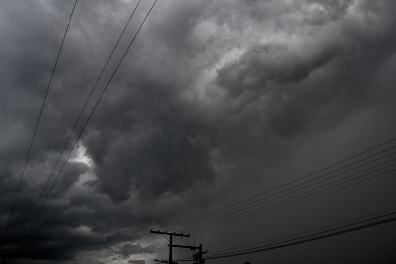
still some more convection (crisp as anything) up towards helensville/kaipara way.
today reminded me of the explosive convection we got on Waitangi Day 2006 when the waterspout was caught of Waiheke.
great day for sure!!!!
we went down to mercer and shot 2 koi carp, one big and one small. While we were there thunder could be heard all around. Initially it sounded like it was over bombay, and then later further south.
awesome gust front on the second system, but didn't have camera on us as we were carrying the bow etc etc.
still some more convection (crisp as anything) up towards helensville/kaipara way.
today reminded me of the explosive convection we got on Waitangi Day 2006 when the waterspout was caught of Waiheke.
great day for sure!!!!
-
NZstorm

- Posts: 11333
- Joined: Mon 10/03/2003 19:38
- Location: Grey Lynn, Auckland
-
NZstorm
- Posts: 11333
- Joined: Mon 10/03/2003 19:38
- Location: Grey Lynn, Auckland
-
ricky
- Posts: 1056
- Joined: Sun 28/09/2003 21:27
- Location: Grey Lynn, Auckland
Just back from a drive around.. sure was a great day!  didn't get far into the Waikato in the end, enjoyed watching from the bombays for a while, saw some interesting mamatus at Mercer, and had some good torrential rain and CGs on the way down the sthn motorway..
Here are the two FC pics i got, was quite brief, you can see by the time i found a clear view it was receding.. although did become quite wide with some good rotation above!
Here are the two FC pics i got, was quite brief, you can see by the time i found a clear view it was receding.. although did become quite wide with some good rotation above!
You do not have the required permissions to view the files attached to this post.

-
Manukau heads obs
- Posts: 12305
- Joined: Mon 10/03/2003 16:30
- Location: West Coast Road, Manukau Peninsula, North Island
WOW!!!!!!!
great stuff Ricky!!!!!!!!!

you can see the wall cloud and all, which the funnel comes down out of
I could see that wall cloud from over this side of the manukau
at the time, the top of the CB looked like the one Steven took a photo of the one over Morrinsville 
almost could be some big hail stones caught in your photo there ricky?
(white streaks)?
or maybe just big drops of rain
great stuff Ricky!!!!!!!!!
you can see the wall cloud and all, which the funnel comes down out of
I could see that wall cloud from over this side of the manukau
at the time, the top of the CB looked like the one Steven took a photo of the one over Morrinsville
almost could be some big hail stones caught in your photo there ricky?
(white streaks)?
or maybe just big drops of rain
Last edited by Manukau heads obs on Sat 10/02/2007 19:55, edited 1 time in total.
-
ricky
- Posts: 1056
- Joined: Sun 28/09/2003 21:27
- Location: Grey Lynn, Auckland
-
spwill
- Posts: 10200
- Joined: Sun 29/06/2003 22:39
- Location: Mt Eden Auckland
-
NZstorm
- Posts: 11333
- Joined: Mon 10/03/2003 19:38
- Location: Grey Lynn, Auckland
-
RODALCO
- Posts: 370
- Joined: Fri 12/01/2007 17:21
- Location: Titirangi, Auckland, New Zealand
FC photo's
Great photo's guys,
After i heard the first rumble of thunder around 16.44 h, i went for a quick drive to Waikumete cemetery near Glen Eden.
Interesting cloud formations and possible rotation although i missed out on a FC.
I spotted one very good vertical strike at 17.15 h and then it started raining, although it didn't last that long and was already clearing less than one hour later.
A couple of very low rainbows were visible very briefly over the city but couldn't get a shot from it.
Looking forward to more action.
Raymond
Who put the LED's on the lightning arrestor ?
-
Paul Mallinson
- Meteorologist (Retired)
- Posts: 406
- Joined: Thu 27/10/2005 20:44
- Location: Greytown
Some very nice pics - especially Ricky's of the wall loud and funnel.
There wasn't very much shear today as I recall but I guess the vigor of the convection plus some local forcing lead to the funnel(s). Will take a look at the radar info tomorrow to see if any rotation is evident.
Has anybody heard of any rainfall rates or hail sizes with these storms?
Paul
There wasn't very much shear today as I recall but I guess the vigor of the convection plus some local forcing lead to the funnel(s). Will take a look at the radar info tomorrow to see if any rotation is evident.
Has anybody heard of any rainfall rates or hail sizes with these storms?
Paul
-
Manukau heads obs
- Posts: 12305
- Joined: Mon 10/03/2003 16:30
- Location: West Coast Road, Manukau Peninsula, North Island
Paul, this Waiuku station:
http://ps.gen.nz/~hamgap/waiuku.htm
shows about 15mm in about 20 minutes
it also shows nicely the temperature drop and wind direction change too
the rain drops were big...but the density of drops was not all that high..thats what i noticed
http://ps.gen.nz/~hamgap/waiuku.htm
shows about 15mm in about 20 minutes
it also shows nicely the temperature drop and wind direction change too
the rain drops were big...but the density of drops was not all that high..thats what i noticed

-
dija
- Posts: 106
- Joined: Sun 22/10/2006 23:06
- Location: Turakina, Wanganui

-
Storm Struck

- Posts: 5057
- Joined: Wed 17/11/2004 21:25
- Location: Belfast Christchurch
Looks like another good day up there great pics especially Ricky's funnel cloud love the rotation .
We got close on Friday evening to getting a thunderstorm here as seen in the other topic but to be honest it has been about nearly two years since we have had a decent thunderstorm go overhead. I am usually not one to complain but I can remember back to 2004 when we were getting lots of storms and you North Islanders were not so you must know what seat we are in .
.
We have had thunderstorms but they seem to go around chch alot mainly because of alot occur in W-SW flows so they tend to move offshore as apposed to a southerly. Bring back the years before 2005 .
Just thought i would have my natter even though i am happy i heard thunder the other day distant though .
I am off up to Havelock,Picton for a week I will come back with some nice pics hopefully .
Cheers
Jason.
We got close on Friday evening to getting a thunderstorm here as seen in the other topic but to be honest it has been about nearly two years since we have had a decent thunderstorm go overhead. I am usually not one to complain but I can remember back to 2004 when we were getting lots of storms and you North Islanders were not so you must know what seat we are in
We have had thunderstorms but they seem to go around chch alot mainly because of alot occur in W-SW flows so they tend to move offshore as apposed to a southerly. Bring back the years before 2005
Just thought i would have my natter even though i am happy i heard thunder the other day distant though
I am off up to Havelock,Picton for a week I will come back with some nice pics hopefully
Cheers
Jason.
Canterbury, home of good rugby and severe storms
-
C-Nimbus
- Posts: 692
- Joined: Tue 20/01/2004 13:22
- Location: Waitakere City - Westie!!
-
spike_01

- Posts: 668
- Joined: Thu 25/08/2005 10:06
- Location: Wellington
-
03Stormchaser

- Moderator
- Posts: 4433
- Joined: Tue 09/12/2003 12:11
- Location: Prebbleton
Nice koi there mate!!C-Nimbus wrote:slightly off topic, but heres one of the koi carp i shot during the thunderstorms yesterday.
this fish is about 15lb in weight
Dunno about that rip in your pants though!!
NZ Largest Storm Chasing Facebook Pagehttp://www.facebook.com/nzstormchasers
NZ Largest Storm Chase Community https://www.facebook.com/groups/NZStormchasersGroup
NZ Stormchasers TV https://www.youtube.com/@NZStormchasers
NZ Largest Storm Chase Community https://www.facebook.com/groups/NZStormchasersGroup
NZ Stormchasers TV https://www.youtube.com/@NZStormchasers