Tropical Cyclone Daman
-
jrj
- Posts: 462
- Joined: Tue 18/03/2003 18:00
- Location: Havelock North, New Zealand
Tropical Cyclone Daman
MetVuw indicate a possible TC near Fiji on Thursday. Something to watch out for.
-
NZ Thunderstorm Soc
- Posts: 19110
- Joined: Wed 12/03/2003 22:08
- Location: Raukapuka Geraldine
-
jrj
- Posts: 462
- Joined: Tue 18/03/2003 18:00
- Location: Havelock North, New Zealand
-
jamie
- Posts: 5907
- Joined: Fri 25/02/2011 21:35
- Location: Hamilton NZ
Re: Tropical Cyclone for Fiji
Looking good for it 
You do not have the required permissions to view the files attached to this post.
-
jamie
- Posts: 5907
- Joined: Fri 25/02/2011 21:35
- Location: Hamilton NZ
Re: Tropical Cyclone for Fiji
Could possibly affect NZ but it is a very long way away yet
You do not have the required permissions to view the files attached to this post.
-
NZ Thunderstorm Soc
- Posts: 19110
- Joined: Wed 12/03/2003 22:08
- Location: Raukapuka Geraldine
Re: Tropical Cyclone for Fiji
thats a long way from Fiji???j--me--h wrote:Could possibly affect NZ but it is a very long way away yet
JohnGaul
NZTS
JohnGaul
NZThS
NZThS
-
jamie
- Posts: 5907
- Joined: Fri 25/02/2011 21:35
- Location: Hamilton NZ
-
NZ Thunderstorm Soc
- Posts: 19110
- Joined: Wed 12/03/2003 22:08
- Location: Raukapuka Geraldine
Re: Tropical Cyclone for Fiji
...anyway TC Bain Bainimararma looks on track for Fiji according to ECWMF 
JohnGaul
NZTS
JohnGaul
NZTS
JohnGaul
NZThS
NZThS
-
Willoughby

- Site Admin
- Posts: 4443
- Joined: Sat 14/06/2003 16:18
- Location: Darwin, Australia: Storm city
Re: Tropical Cyclone Daman
Well, TC Daman / 05P was named yesterday afternoon by RSMC Nadi and looks very good at this time of night with strong convection to the south with it steering to the southeast.

"FOR FIJI EXPECT WINDS TO STRENGTHEN OVER THE NORTHERN AND WESTERN
AREAS LATER TODAY AND POSSIBLY REACH DAMAGING GALE FORCE ON FRIDAY.
RAIN BECOMING WIDESPREAD AND FREQUENT WITH HEAVY FALLS AND SQUALLY
THUNDERSTORMS. FLOODING OF LOW-LYING AREAS.
THE FOLLOWING INFORMATION IS PROVIDED ESPECIALLY FOR THE MARINERS:
DESTRUCTIVE STORM FORCE WINDS WITHIN 40 NAUTICAL MILES OF CENTRE.
VERY HIGH SEAS. DAMAGING GALE FORCE WINDS WITHIN 90 MILES OF CENTRE
IN THE SOUTHEAST SEMI-CIRCLE AND 70 NAUTICAL MILES OF CENTRE IN THE
NORTHWEST SEMI-CIRCLE . VERY ROUGH TO HIGH SEAS. DAMAGING HEAVY
SWELLS.
http://www.met.gov.fj/index.php?id=37
-
NZ Thunderstorm Soc
- Posts: 19110
- Joined: Wed 12/03/2003 22:08
- Location: Raukapuka Geraldine
Re: Tropical Cyclone Daman
I disagree with the name of the TC. should be a Fijian name like Speight, or Rabuka 
Who the bloody hell is Daman?
JohnGaul
NZTS
Who the bloody hell is Daman?
JohnGaul
NZTS
JohnGaul
NZThS
NZThS
-
Manukau heads obs
- Posts: 12305
- Joined: Mon 10/03/2003 16:30
- Location: West Coast Road, Manukau Peninsula, North Island

-
Willoughby
- Site Admin
- Posts: 4443
- Joined: Sat 14/06/2003 16:18
- Location: Darwin, Australia: Storm city
Re: Tropical Cyclone Daman
What a difference 24 hours makes! Aiming right for mainland! 
HURRICANE WARNING 008 ISSUED FROM RSMC NADI Dec 06/1304 UTC 2007 UTC.
TROPICAL CYCLONE DAMAN [970HPA] CENTRE WAS LOCATED NEAR 15.4 SOUTH 176.2 EAST AT
061200 UTC.
POSITION GOOD.
REPEAT POSITION 15.4S 176.2E AT 061200 UTC.
CYCLONE IS NOW MOVING SOUTHEAST ABOUT 06 KNOTS.
CYCLONE INTENSIFYING.
EXPECT SUSTAINED WINDS OF 65 KNOTS CLOSE TO THE CENTRE POSSIBLY INCREASING TO 70
KNOTS IN THE NEXT 12 TO 24 HOURS.
EXPECT WINDS OVER 47 KNOTS WITHIN 50 MILES OF CENTRE AND
OVER 33 KNOTS WITHIN 100 MILES OF THE CENTRE IN THE SOUTHEAST
SEMICIRCLE AND WITHIN 70 MILES OF CENTRE IN THE NORTHWEST SEMICIRCLE
You do not have the required permissions to view the files attached to this post.
-
jamie
- Posts: 5907
- Joined: Fri 25/02/2011 21:35
- Location: Hamilton NZ
Re: Tropical Cyclone Daman
man fiji is going to be naild
That thing looks to have intensified a heap since yesturday
That thing looks to have intensified a heap since yesturday
-
gllitz

- Posts: 1335
- Joined: Wed 04/01/2006 11:45
- Location: Perth, Western Australia
Re: Tropical Cyclone Daman
Heard on Radio Live news bulletion this morning from one of the main weather-gurus in Fiji that it is forecast to become a Cat-4 by the time it hits
Here's hoping people have been smart enough to get to shelters/high ground in time...there has been plenty of warning.
EDIT: (latest from Joint Typhoon Warning Center)
REMARKS:
062100Z POSITION NEAR 15.6S 177.4E.
TROPICAL CYCLONE (TC) 05P (DAMAN) LOCATED APPROXIMATELY 120 NM NORTH
OF NADI, FIJI, HAS TRACKED EASTWARD AT 08 KNOTS OVER THE PAST 06 HOURS.
TC 05P HAS UNDERGONE A PERIOD OF EXPLOSIVE DEEPENING SUPPORTED BY HIGH
OCEAN HEAT CONTENT AND STRONG UPPER LEVEL OUTFLOW DURING THE PAST 06
HOURS. DVORAK SATELLITE INTENSITY ESTIMATES FROM REPORTING AGENCIES
RANGE FROM 5.0/5.0 (PHFO) TO 6.0/6.0 (PGTW) AND THE INITIAL INTENSITY
IS SET ACCORDINGLY AT 100 KNOTS. ALTHOUGH THE INTENSITY FORECAST HAS
BEEN UPDATED TO REFLECT RECENT IMPROVEMENTS IN STORM STRUCTURE, TRACK
FORECAST REASONING HAS NOT CHANGED. TC 05P WILL CONTINUE TO TRACK ALONG
THE SOUTHWESTERN PERIPHERY OF A SUBTROPICAL RIDGE AHEAD OF AN APPROACH-
ING MID-LATITUDE TROUGH CURRENTLY LOCATED SOUTHWEST OF THE STORM. THE
CONTINUING INFLUENCES OF GOOD OUTFLOW ALOFT AND WARM WATER BELOW WILL
ALLOW THE STORM TO FURTHER INTENSIFY PRIOR TO MAKING LANDFALL ON VANUA
LEVU ISLAND BETWEEN TAU 12 AND TAU 24. THEREAFTER, LAND INTERACTION AND
DECREASING OCEAN HEAT CONTENT ARE EXPECTED TO INDUCE STRUCTURAL CHANGES
AND SLOW WEAKENING THROUGH TAU 36. MORE RAPID WEAKENING SHOULD OCCUR
BETWEEN TAU 36 AND TAU 48 AS VERTICAL WIND SHEAR ASSOCIATED WITH THE
APPROACHING TROUGH INCREASES. MAXIMUM SIGNIFICANT WAVE HEIGHT AT
061800Z IS 25 FEET. NEXT WARNINGS AT 070900Z AND 072100Z.//
You do not have the required permissions to view the files attached to this post.
"Saru mo ki kara ochiru"
-
Inny Binny
- Posts: 553
- Joined: Sat 01/09/2007 12:15
- Location: Prebbleton
Re: Tropical Cyclone Daman
Did that pic say max wind gust of 135 knots?
Man, fiji is going to get nailed.
Man, fiji is going to get nailed.
-
Willoughby
- Site Admin
- Posts: 4443
- Joined: Sat 14/06/2003 16:18
- Location: Darwin, Australia: Storm city
Re: Tropical Cyclone Daman
Category 4 now.
I can't access the Fiji Met site due to overloading... MetService TCWC Wellington will have to take responsibility if Nadi can't complete their duties!
They were talking about momentary gusts to 250 km/h in one bulletin.
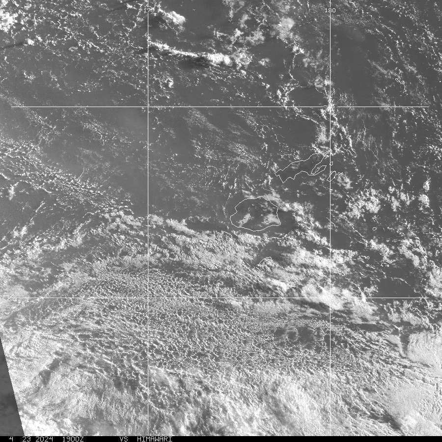
Latest vis satellite: http://www.goes.noaa.gov/sohemi/SHGMSB.JPG
I can't access the Fiji Met site due to overloading... MetService TCWC Wellington will have to take responsibility if Nadi can't complete their duties!
They were talking about momentary gusts to 250 km/h in one bulletin.
Latest vis satellite: http://www.goes.noaa.gov/sohemi/SHGMSB.JPG
-
Michael

- Posts: 7210
- Joined: Thu 27/03/2003 12:04
- Location: Rainy Manurewa, Auckland - "City of Gales"
Re: Tropical Cyclone Daman
Heres their map
Can see the eye well
Can see the eye well
You do not have the required permissions to view the files attached to this post.
-
Willoughby
- Site Admin
- Posts: 4443
- Joined: Sat 14/06/2003 16:18
- Location: Darwin, Australia: Storm city
Re: Tropical Cyclone Daman
925mb in the latest update!
HURRICANE WARNING 010 ISSUED FROM RSMC NADI Dec 07/0118 UTC 2007 UTC.
SEVERE TROPICAL CYCLONE DAMAN CENTRE [925HPA] CATEGORY 4 WAS LOCATED NEAR 15.6
SOUTH 177.8 EAST AT 070000 UTC.
POSITION GOOD.
REPEAT POSITION 15.6 SOUTH 177.8 EAST AT 070000 UTC.
CYCLONE MOVING SOUTHEASTWARDS AT ABOUT 07 KNOTS.
CYCLONE INTENSIFYING.
EXPECT SUSTAINED WINDS OF 105 KNOTS CLOSE TO THE CENTRE POSSIBLY INCREASING TO
115 KNOTS IN THE NEXT 6 TO 18 HOURS.
EXPECT WINDS OVER 64 KNOTS WITHIN 35 MILES OF THE CENTRE AND
OVER 47 KNOTS WITHIN 55 MILES OF CENTRE AND
OVER 33 KNOTS WITHIN 90 MILES OF THE CENTRE IN THE SOUTHEAST
SEMICIRCLE AND WITHIN 80 MILES OF CENTRE IN THE NORTHWEST SEMICIRCLE.
-
spwill
- Posts: 10200
- Joined: Sun 29/06/2003 22:39
- Location: Mt Eden Auckland
-
jamie
- Posts: 5907
- Joined: Fri 25/02/2011 21:35
- Location: Hamilton NZ
Re: Tropical Cyclone Daman
is there any way of watching this as it makes landfall other than just sat images. are there any weather stations online in the area?
I cant get over how it intensified so quickly. gotta feel bad for what people are going to through tonight..but i sure wish i was there to feel the force of it
I cant get over how it intensified so quickly. gotta feel bad for what people are going to through tonight..but i sure wish i was there to feel the force of it
-
Inny Binny
- Posts: 553
- Joined: Sat 01/09/2007 12:15
- Location: Prebbleton
-
NZ Thunderstorm Soc
- Posts: 19110
- Joined: Wed 12/03/2003 22:08
- Location: Raukapuka Geraldine
Re: Tropical Cyclone Daman
ECMWF did a good job foreasting TC Speight, even though it was a bit early with it.
JohnGaul
NZTS
JohnGaul
NZTS
JohnGaul
NZThS
NZThS
-
Willoughby
- Site Admin
- Posts: 4443
- Joined: Sat 14/06/2003 16:18
- Location: Darwin, Australia: Storm city
Re: Tropical Cyclone Daman
Daman did well overnight to steer away from Vanua Levu and lose a lot of organisation...
Looks like it'll curve around to the southwest and break up against the strong high to our east.
Looks like it'll curve around to the southwest and break up against the strong high to our east.
-
Andrew Massie
- Posts: 1032
- Joined: Fri 10/03/2006 14:03
Re: Tropical Cyclone Daman
Me! I'm Da man!NZ Thunderstorm Soc wrote:Who the bloody hell is Daman?
JohnGaul
NZTS
-
Andrew Massie
- Posts: 1032
- Joined: Fri 10/03/2006 14:03
Re: Tropical Cyclone Daman
Yeah, it took a funny track.. Doesn't land suck TCs towards it and then the TC weakens usually?Foggy wrote:Daman did well overnight to steer away from Vanua Levu and lose a lot of organisation...
Looks like it'll curve around to the southwest and break up against the strong high to our east.