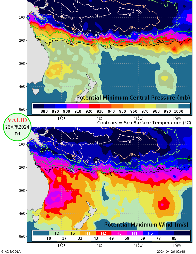
Looking very unstable weather for ECA (east coast australia) in couple next days:
https://www.fnmoc.navy.mil/CGI/PUBLIC/w ... z&prod=prp
The models still have a low pressure system off the coast here but:
"An upper low will move into Qld on Monday and then move eastwards. This upper
low will most likely pass off the southern coast late in the week. As the low
moves eastwards it will destablize conditions so that from about Tuesday onwards
showers should become more scattered along the southern and central coasts and
penetrate into the adjacent inland. As well, this low will induce a trough off
the southern coast. This will result in strong winds developing along the
southern coast and cause seas to rise to rough."
By QLD BOM.
I am sure that low pressure would swing our weather to worsen as the winds could reach 100km/hr and flash flooding during this event. I am very exciting but scary
